


Garmin aera 500 Series Pilot’s Guide
190-01117-02 Rev. A
88
Hazard Avoidance
OverviewGPS NavigationFlight PlanningHazard AvoidanceAdditional FeaturesAppendicesIndex
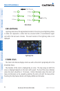
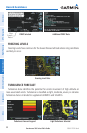
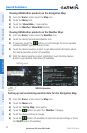
PIREP Selected Additional PIREP Data
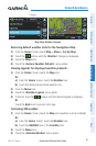
Map
Feature
Button
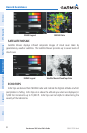
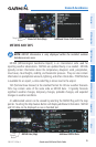
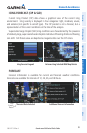
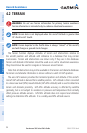
FREEZING LEVELS
Freezing Level shows contours for the lowest forecast altitude where icing conditions
are likely to occur.
Freezing Level Data
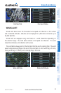
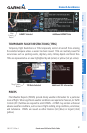
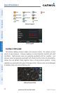
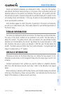
TURBULENCE FORECAST
Turbulence data identifies the potential for erratic movement of high-altitude air
mass associated winds. Turbulence is classified as light, moderate, severe, or extreme.
Turbulence data is intended to supplement AIRMETs and SIGMETs.
Turbulence Forecast Legend Light Turbulence Selected