


Garmin aera 500 Series Pilot’s Guide
190-01117-02 Rev. A
45
GPS Navigation
Overview GPS Navigation Flight Planning Hazard Avoidance Additional Features Appendices Index
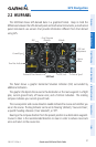
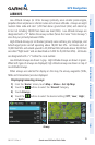
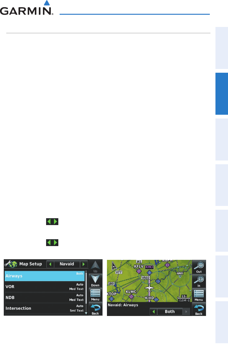
AIRWAYS
Low Altitude Airways (or Victor Airways) primarily serve smaller piston-engine,
propeller-driven airplanes on shorter routes and at lower altitudes. Airways are eight
nautical miles wide and start 1,200 feet above ground level (AGL) and extend up
to but not including 18,000 feet mean sea level (MSL). Low Altitude Airways are
designated with a “V” before the airway number (hence the name “Victor Airways”)
since they run primarily between VORs.
High Altitude Airways (or Jet Routes) primarily serve airliners, jets, turboprops, and
turbocharged piston aircraft operating above 18,000 feet MSL. Jet Routes start at
18,000 feet MSL and extend upward to 45,000 feet MSL (altitudes above 18,000 feet
are called “flight levels” and are described as FL450 for 45,000 feet MSL). Jet Routes
are designated with a “J” before the route number.
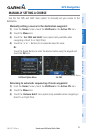
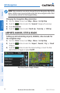
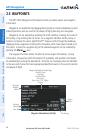
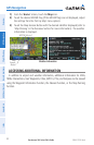
Low Altitude Airways are drawn in gray. High Altitude Airways are drawn in green.
When both types of airways are displayed, high altitude airways are drawn on top of
Low Altitude Airways.
When airways are selected for display on the map, the airway waypoints (VORs,
NDBs and Intersections) are also displayed.
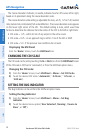
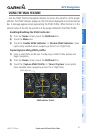
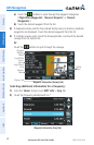
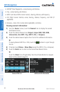
Displaying/removing airways:
1)
From the 'Home' Screen, touch Map > Menu > Set Up Map
2)
Touch the buttons to select the 'Navaid' Category.
3)
Touch Airways.
4)
Touch the buttons to select the desired setting ('Off', 'Low', 'High',
or 'Both').
Airways