


13
Zooming, Panning and Pointing
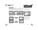
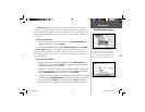
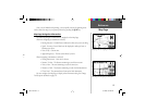
There are three main actions you can perform on the Map Page: zooming, panning
and pointing. The map display has map scales from 20 feet to 800 miles. The current
map scale is indicated on the bottom left corner of the map display.
To change the map scale:
1. Press the IN zoom key to see a smaller area with more detail.
2. Press the OUT zoom key to see a larger area with less detail.
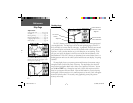
When zoomed in to smaller map areas, ‘overzoom’ appears directly below the map
scale. This indicates the current scale exceeds the optimum resolution of available map
detail. Extra caution should be used in ‘overzoom’ since some detail, such as roads, are
drawn using widely spaced points and the actual layout of these details may differ from
the map presentation. More detailed map features as well as information about those
features can be displayed using map data transferred from the MapSource City Select
CD-ROM. When using MapSource data, the word “MapSource” will appear below the
map scale whenever you zoom in to view map details.
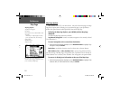
Panning allows you to move the map in order to view areas beyond the current map
area. This provides a ‘look ahead’ capability which is particularly useful with smaller
map areas. To pan, use the ROCKER KEYPAD to move the map in any direction,
including diagonally.
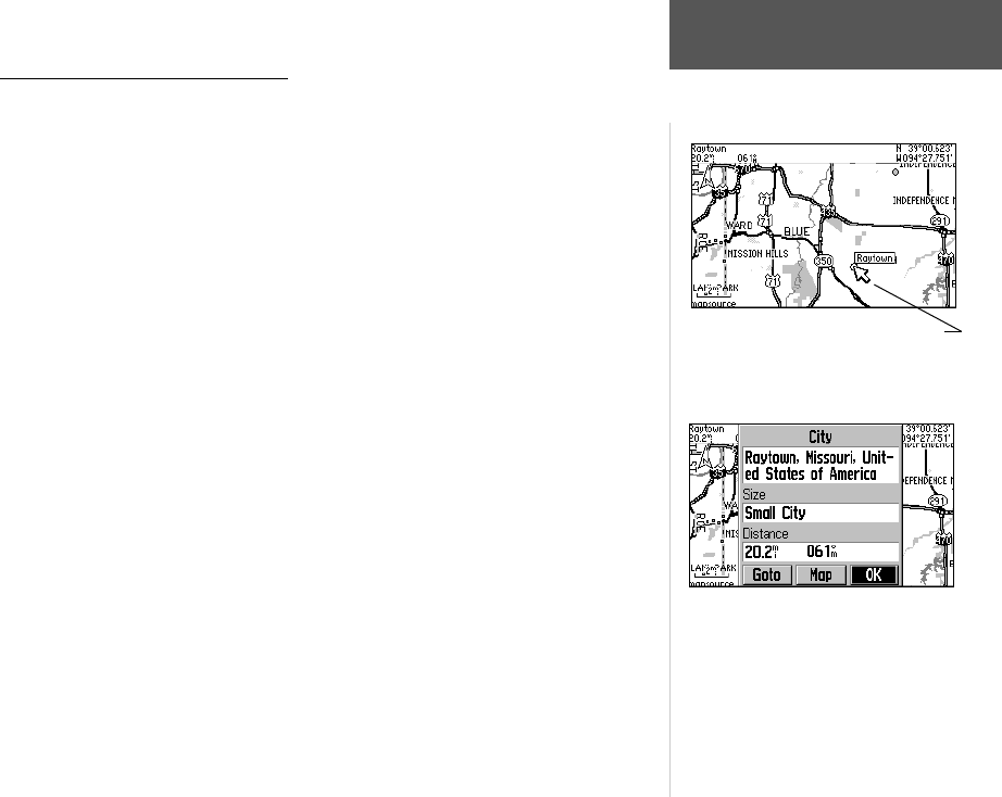
As you begin to pan the map, a pointer appears. This map pointer will serve as
a target marker for the map. If you change the scale, the map is redrawn with the
pointer at the center. When the pointer is placed on an object, the name of that object
will be highlighted. (If the name wasn’t originally displayed, it will appear when the
pointer is placed on the object.) This feature applies to everything displayed on the
Reference
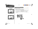
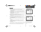
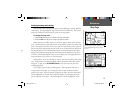
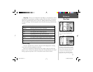
Map Page
The Map Page showing the panning arrow
and a highlighted map feature or point of
interest.
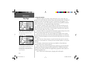
The Information Page for the city highlighted
in the screen above.
GPS V OM.indd 13 5/7/2003, 8:52:56 AM