


11
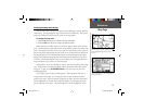
New Elevation—allows you to designate your approximate altitude in order to
better refi ne a 2D position. By default, 2D positioning will attempt to use the last
known altitude. If the altitude is off by several hundred feet (or more), manually enter-
ing your approximate altitude will enable the receiver to more accurately determine a
position fi x.
To enter an elevation:
1. With the Satellite Status Page Options displayed, use the ROCKER KEYPAD to
highlight ‘New Elevation’ and press ENTER.
2. Enter your approximate elevation using the ROCKER KEYPAD, and press ENTER.
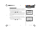
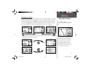
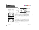
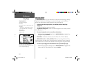
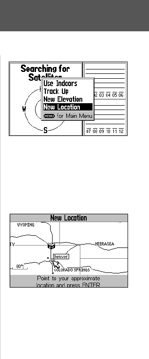
New Location—allows you to designate your approximate position in order to
speed up satellite acquisition. This option is useful if you have relocated 500 or more
miles since the last time you used the GPS V, and ensures that the unit is looking for
the proper satellites.
To enter a new location:
1. With the Satellite Status Page Options displayed, use the ROCKER KEYPAD to
highlight ‘New Location’ and press ENTER. A second pop-up window appears list-
ing two options: ‘Automatic’ and ‘Use Map’.
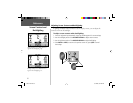
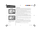
2. ‘Automatic’ causes the GPS V to search for any available satellite(s) to determine a
position. This process can take 3-5 minutes as the unit determines its new location.
Use the ROCKER KEYPAD to select ‘Automatic’ and press ENTER.
3. ‘Use Map’ allows you to designate your approximate position directly from a graphic
map display. Use the ROCKER KEYPAD to place the pointer arrow on your approxi-
mate location and press ENTER. You may wish to use the IN/OUT zoom keys to
adjust the level of detail displayed, as you determine your approximate position.
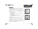
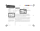
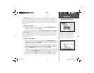
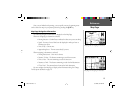
Satellite Status Page
If you have moved several hundred miles or
more since you last used the GPS V, letting
the GPS V know your approximate location
will ensure that it is looking for the right
satellites and will speed up satellite acquisi-
tion.
New Location highlighted on the map.
Reference
GPS V OM.indd 11 5/7/2003, 8:52:54 AM