


86
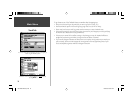
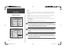
Main Menu
)
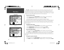
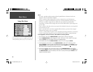
Speed Filter— Auto: automatically averages speed readings; Off: disables speed fi ltering; On: allows
you to manually enter a fi ltering value from 1 to 255 seconds.
Language— allows you to select between available languages used on-screen for tabs, menu options
and main page descriptions.
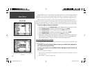
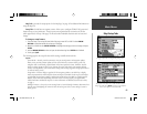
VNAV
The ‘VNAV’ fi le tab provide settings for the vertical navigation feature. These settings create a three-
dimensional profi le which guides you from your present position and altitude to a fi nal (target)
altitude at a specifi ed location. Once the profi le is defi ned, message alerts and additional data on the
HSI Page will keep you informed of your progress. The user-defi ned data fi elds on the HSI Page can
display time to beginning of VNAV maneuver (ETV), glide ratio and vertical speed to target. Expect
the following to occur when using the GPSMAP 196’s VNAV features:
• As you approach the initial descent point, the time to vertical navigation fi eld (ETV) indicates the
time to reach the initial descent point.
• At one minute prior to the initial descent point, a message ‘Approaching VNAV Profi le’ occurs. The
time to vertical navigation will sequence from indicating time to initial descent point to indicating
time to reach the target altitude. Finally, the descent angle will lock to prevent changes in speed
from altering the profi le. Keep this in mind, since the VNAV feature will not take into account any
changes in groundspeed that occur during the transistion from level fl ight to descent or climb.
• At 500 feet above the target altitude, an ‘Approaching Target Altitude’ message appears. The time
to vertical navigation will go blank and the VNAV indicator will disappear from the HSI Page.
GPS accuracy may be degraded by the U.S. Department of Defense imposed Selective
Availability (SA) program. With ‘SA’ on, GPS altitude may be in error by several hundred
feet. Errors of this magnitude may result in fl uctuations in the VNAV indicator on the HSI
Page. The GPSMAP 196 is a VFR navigation tool and should not be used to perform instru-
ment approaches.
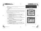
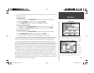
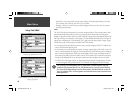
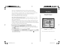
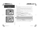
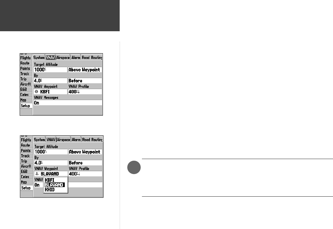
Setup Tab: VNAV
Use the VNAV screen to defi ne a vertical navigation profi le,
including target altitude and descent rate.
When navigating a route, you can use the VNAV feature to aid
in climbs or descents by selecting an interim route waypoint and
defi ning target altitude.
190-00283-00Backup.indd 86 12/8/2002, 8:09:41 PM