


12
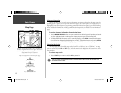
Main Pages
Map Page
Airspace Information
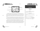
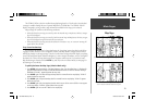
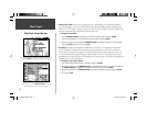
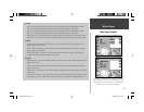
Cursor mode may also be used to retrieve information on airspaces depicted on the map. Once the
panning pointer is placed on an open area within an airspace, the entire airspace (or airspace sector) is
highlighted. A text box adjacent to the panning pointer will indicate the airspace type and fl oor/ceiling
limits. Additional information, including communication frequencies, is available from an information
page.
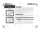
To retrieve airspace information from the Map Page:
1. Use the ARROW KEYPAD to select an open area within the desired airspace’s boundary. The bound-
ary line is highlighted and a window appears showing airspace type and fl oor/ceiling limits.
2. To display additional information, such as controlling agency, press ENTER. Communication frequen-
cies may then be displayed by highlighting the on-screen “Frequencies” button and pressing ENTER.
Or, with the on-screen “OK” button highlighted, press ENTER to return to the Map Page.
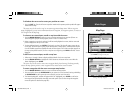
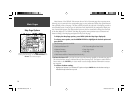
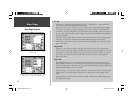
Selecting Map Scales
The map display has 28 available range scales from 20 ft. to 800 mi. (5 m to 1200 km). The map
scale is controlled by the IN and OUT keys, with the current scale displayed at the bottom right of the
data window.
To select a map scale:
1. Press the OUT key to zoom out and the IN key to zoom in.
The scale value represents the distance from one end of the scale bar to the other, not
across the entire screen.
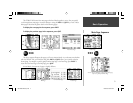
When the pointer is placed inside an airspace boundary, the
boundary is highlighted and a text box appears. The text box
indicates airspace type and fl oor/ceiling limits. Press ENTER to
display additional airspace information.
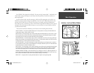
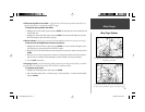
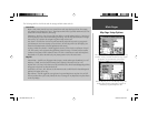
Map scale info appearing at the bottom of the page:
Using Built-In Basemap
Using MapSource Data
Overzoom, no additional data
)
190-00283-00Backup.indd 12 12/8/2002, 8:08:52 PM