


19
Main Pages
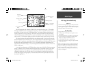
Map Page Options
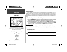
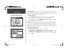
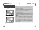
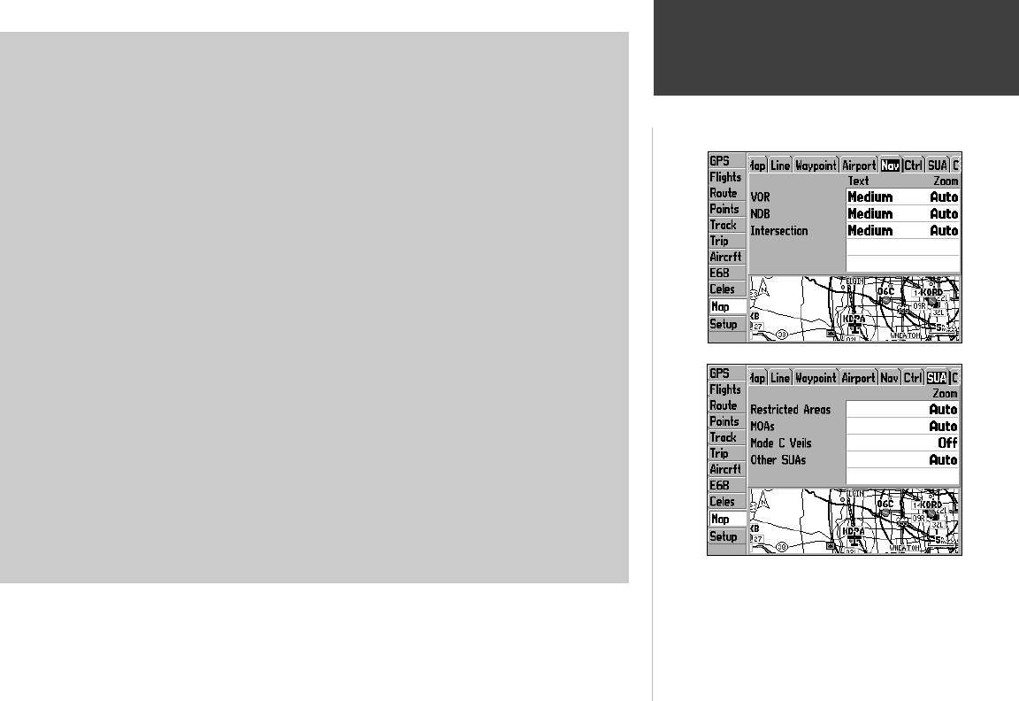
Nav Tab
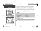
VOR— Text Off, Small, Medium, and Large: controls the screen size of the VOR identifi er. Zoom
Auto, Off, 20 ft.-800 mi: sets the maximum scale at which VORs appear on the screen.
NDB— Text Off, Small, Medium, and Large: controls the screen size of the NDB identifi er. Zoom
Auto, Off, 20 ft.-800 mi: sets the maximum scale at which NDBs appear on the screen.
Intersection— Text Off, Small, Medium, and Large: controls the screen size of the intersection name.
Zoom Auto, Off, 20 ft.-800 mi: sets the maximum scale at which intersections appear on the screen.
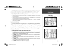
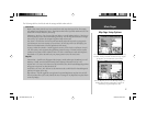
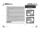
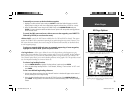
Ctrl Tab
Class B, CTA— Zoom Auto, Off, 20 ft.-800 mi: sets the maximum scale at which Class B or CTA
airspace appears on the screen.
Class C, TMA— Zoom Auto, Off, 20 ft.-800 mi: sets the maximum scale at which Class C or TMA
airspace appears on the screen.
Towers, Cntrl Zone— Zoom Auto, Off, 20 ft.-800 mi: sets the maximum scale at which Tower or
Control Zone (Class D) airspace appears on the screen.
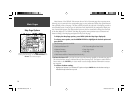
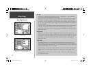
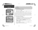
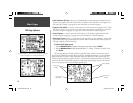
SUA Tab
Restricted Areas— Zoom Auto, Off, 20 ft.-800 mi: sets the maximum scale at which restricted airspace
appears on the screen.
MOAs— Zoom Auto, Off, 20 ft.-800 mi: sets the maximum scale at which military operation areas
appear on the screen.
Mode C Veils— Zoom Auto, Off, 20 ft.-800 mi: sets the maximum scale at which Mode C veils appear
on the screen.
Other SUAs— Zoom Auto, Off, 20 ft.-800 mi: sets the maximum scale at which other airspace catego-
ries appear on the screen. ‘Other SUAs’ includes training, caution, danger, warning and alert areas.
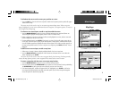
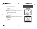
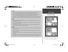
Use the ‘Nav’, ‘Ctrl’ and ‘SUA’ tabs to defi ne how navaids and
airspace boundaries will appear on the map display. The ‘Text’
setting determines the size of navaid names. ‘Zoom’ defi nes the
maximum scale at which the feature will appear.
190-00283-00Backup.indd 19 12/8/2002, 8:08:57 PM