


15
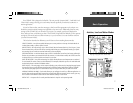
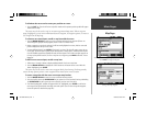
Main Pages
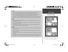
Map Page Options
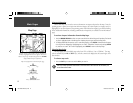
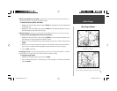
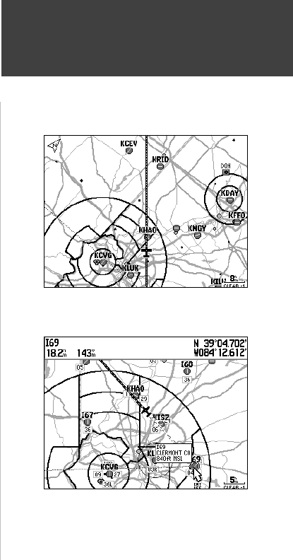
Use the ‘Measure Distance’ option to measure distance between
two points. Bearing and distance appears at the top of the page.
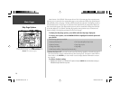
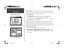
The ‘Full Screen’ option displays a full screen map without the
data fi elds or graphic HSI.
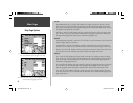
• Full Screen Map/Show Data Fields— toggles between a full screen map without data fi elds, or a
map with data fi elds on the right-hand side of the page.
To maximize the map/show data fi elds:
1. Highlight the ‘Full Screen Map’ option and press ENTER. The Map Page will now be maximized with
no data fi elds. OR,
1. Highlight the ‘Show Data Fields’ option and press ENTER. The Map Page will display the map with
data fi elds along the right-hand side of the page.
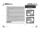
• Measure Distance— allows you to measure the bearing/distance between two points on the map.
To measure the Bearing/Distance between two points:
1. Highlight the ‘Measure Distance’ option and press ENTER. An on-screen pointer will appear on the
map display at your present position with ‘ENT REF’ below it.
2. Move the cursor to the desired reference point (the point that you want to measure from) and press
ENTER.
3. Move the cursor to the point you want to measure to. The bearing and distance from the reference
point and cursor coordinates will be displayed in the data window at the top of the display.
4. Press the QUIT key to fi nish.
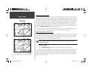
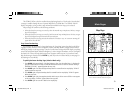
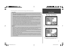
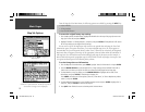
• Setup Page Layout— provides Map Page display options for four large-text data fi elds, ten smaller-
text data fi elds or four data fi elds with an HSI (or RMI in Land/Water modes).
To setup the page layout:
1. Highlight the ‘Setup Page Layout’ option and press ENTER.
2. Select the desired option, None, 1 Column (Large), 2 Columns (Small), or 2 Columns with HSI (RMI),
and press ENTER.
190-00283-00Backup.indd 15 12/8/2002, 8:08:54 PM