


13
Main Pages
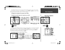
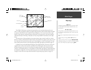
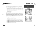
Map Page
The GPSMAP 196 has a built-in worldwide map displaying detail to a 20 mile scale. More detailed
coverage is available through the use of optional MapSource CD-ROM data. The GPSMAP 196 will
display cartography as long as there is map information available for the range you’ve selected.
Map coverage will conform to the following conditions:
• When the selected zoom range is covered by either the internal map or MapSource CD data, cartogra-
phy will be displayed.
• When the selected zoom range is covered by both the internal map and MapSource CD data, cartogra-
phy will be displayed using the data with the best resolution.
• When the selected zoom range exceeds the resolution of the data in use, an ‘overzoom’ warning will
appear below the scale fi eld.
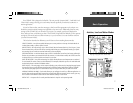
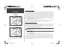
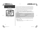
Easy Screen Decluttering
You can select the desired level of map detail using the ‘Setup Map’ option described on the follow-
ing page. You may, however, wish to temporarily remove some map detail in congested areas without
making any changes to the map settings. There are four declutter settings which will display everything,
remove the background detail (lakes/rivers/highways), remove airspace boundaries, and—at the highest
declutter level—remove all map detail except those waypoints which are part of your selected route.
Map decluttering is selected with the ENTER key, and only works in Position Mode (see next page for
decluttering in Cursor Mode).
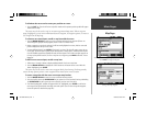
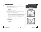
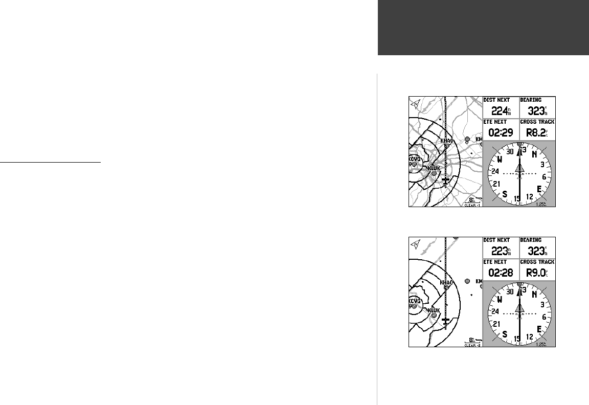
To quickly declutter the Map Page (Aviation Mode only):
1. Press ENTER. Background detail—including highways, cities, rivers & smaller lakes—is displayed in
gray (de-emphasized) on the map to make the aviation data easier to read. This declutter setting is
identifi ed by ‘CLEAR-1’ appearing below the map scale.
2. Press ENTER again. The above background map detail is removed from the map display. ‘CLEAR-2’
appears below the map scale.
3. Press ENTER again. Airspace boundary detail is removed from the map display. ‘CLEAR-3’ appears
below the map scale.
4. Press ENTER again. Only the waypoints/navaids which are part of the current GOTO or route appear
on the map display. ‘CLEAR-4’ appears below the map scale.
5. Press ENTER again to return ALL detail to the map display.
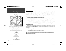
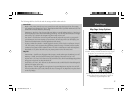
First declutter level with background (basemap) detail in gray.
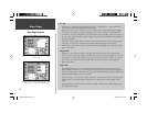
Second declutter level with background detail off. Note the
‘Clear-2’ declutter indication below the map scale.
190-00283-00Backup.indd 13 12/8/2002, 8:08:53 PM