


27
Main Pages
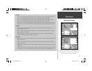
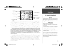
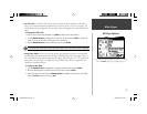
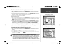
HSI Page Options
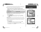
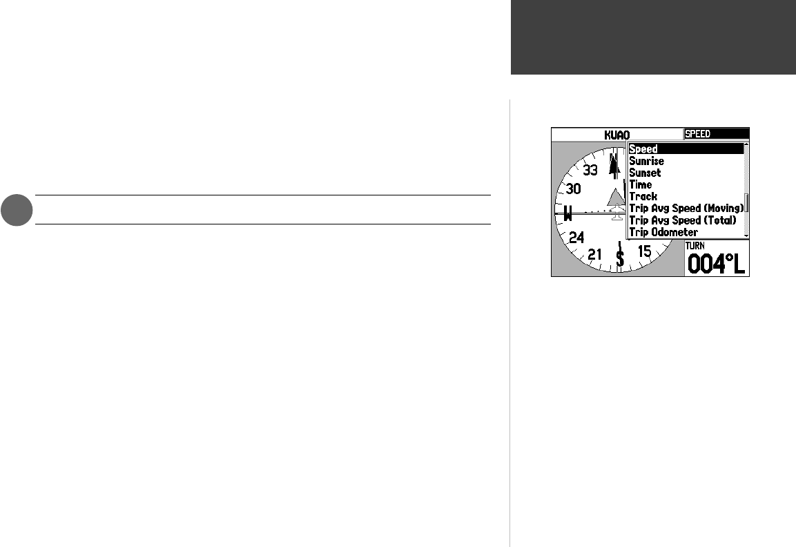
Select ‘Change Data Fields’, highlight the fi eld you wish to change
and press ENTER to display a list of available data types.
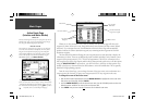
• Set CDI Scale— sets the full scale limits of the course deviation scale and needle. The default set-
ting is ±1.25 (nautical mile/statute mile/kilometer), but can also be set to ±0.25 or ±5.0 ranges. The
current setting is always displayed at the lower right corner of the graphic HSI (on the HSI and Panel
Pages).
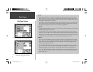
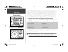
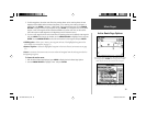
To change the CDI Scale:
1. With the HSI (or Panel Page) displayed, press MENU to display the HSI Page Options.
2. Use the ARROW KEYPAD to highlight the ‘Set CDI Scale’ option and press ENTER. A window will
appear at the center of the HSI, showing the current scale setting.
3. Use the ARROW KEYPAD to select the desired scale and press ENTER.
The IN and OUT zoom keys may also be used to adjust CDI scale when no map is displayed.
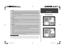
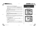
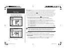
• Change Data Fields— allows you to choose the data types displayed on the four or ten data fi elds
appearing along the right-hand side of the HSI Page. (Panel Page data cannot be changed.) There are
over forty different data options including: altitude, bearing, course, distance, ETA, ETE, speed, track
and a pointer. You can review the complete list on the GPSMAP 196, and refer to Appendix D for
defi nitions of each data fi eld term.
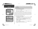
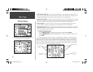
To change a data fi eld:
1. Use the ARROW KEYPAD to highlight the ‘Change Data Fields’ option and press ENTER.
2. Move the fi eld highlight to the data fi eld you want to change and press ENTER.
3. Move up or down on the list using the ARROW KEYPAD to highlight the data you want to display,
and press ENTER to select. To exit, press QUIT.
)
190-00283-00Backup.indd 27 12/8/2002, 8:09:02 PM