42
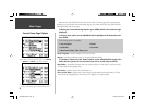
Waypoint Categories
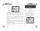
Using the Direct To Key
The DIRECT TO key operates in the same fashion in Aviation,
Land and Water modes. Pressing the DIRECT TO key displays
the Goto Page, which allows you to select an airport or navaid, a
recently (previously) used waypoint, or a user-created waypoint as
your destination.
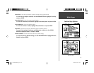
When a ‘Goto’ or route is currently in use, holding the
DIRECT TO key down briefl y displays a detailed information
page for the current destination.
IMPORTANT: When selecting airports, please note that the
GPSMAP 196 uses International Civil Aviation Organization
(ICAO) identifi ers to designate airports. This means some three-
character identifi ers may be different from what you are used to.
In the contiguous United States, the prefi x letter “K” is used for
ALL airports with a three letter identifi er. Therefore, airports such
as “JFK” become “KJFK”. This DOES NOT apply to airports with
letter and number identifi ers. Airports such as “H41” and “4M1”
do not use the “K” prefi x.
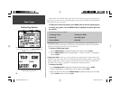
Direct To ( D )
The GPSMAP 196 includes an internal Jeppesen
®
database, additional memory for up to 1000 user-
created waypoints and accepts optional memory cards to display MapSource data. The Jeppesen data-
base provides position and facility information for thousands of airports, VORs, NDBs and intersections.
Each facility in the database is stored as a ‘waypoint’, with its own latitude/longitude location, identifi er
(up to six letters and/or numbers) and other pertinent information. Updates to the Jeppesen database
are available every 28 days online (www.garmin.com). The update program is designed to operate on
Windows
®
-compatible PCs and requires the included PC Interface Cable to connect your GPSMAP 196
to the PC’s serial communications port.
The following information is provided from the internal Jeppesen database:
• Airports— identifi er, facility name, city/state/country, position (latitude/longitude), fi eld eleva-
tion, available fuel types, runway designations/layout, runway surface(s), runway length(s),
runway width(s), runway lighting, communication frequencies and published approaches.
• VORs— identifi er, facility name, city/state/country, position (latitude/longitude), frequency and
co-located weather, DME or TACAN availability.
• NDBs— identifi er, facility name, city/state/country, position (latitude/longitude), frequency and
co-located weather broadcast availability.
• Intersections— identifi er, nearest VOR, radial and distance from nearest VOR, position (latitude/
longitude) and region/country.
Any user-created waypoints will include the following information:
• User Waypoints— name (up to ten characters in length), symbol, position (latitude/longitude),
elevation and comment.
Optional memory cards and MapSource CD-ROMs enhance the versatility of your GPSMAP
196—providing automatic route calculation capability and allowing you to display additional street
detail, topographic maps, highway exit information and points of interest. With optional MapSource
City Select or MetroGuide data, you can view listings of nearby restaurants, lodging, shopping centers,
attractions and entertainment, and even retrieve addresses and phone numbers for any listed location.
The same PC Interface Cable, mentioned above for database updates, is required to transfer MapSource
CD-ROM data to the optional memory card.
190-00283-00Backup.indd 42 12/8/2002, 8:09:11 PM


