


74
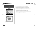
Main Menu
Points Tab
)
)
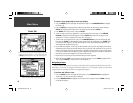
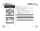
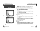
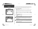
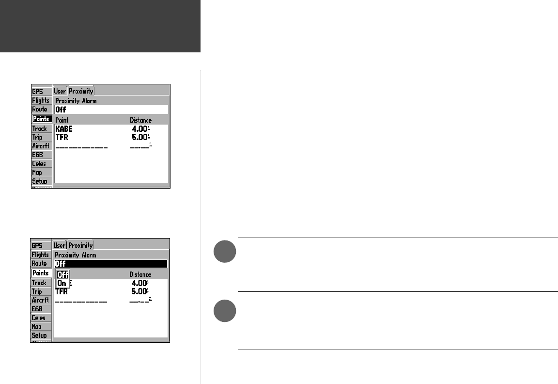
The second screen under the ‘Points’ tab is devoted to Proximity Waypoints, which are existing
waypoints that have an alarm circle defi ned around the waypoint location. You select the waypoints for
which you want proximity alarms, and enter the desired alarm radius. The GPSMAP 196 stores up to
ten proximity waypoints with a maximum alarm radius of 99.99 nautical or statute miles.
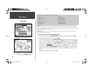
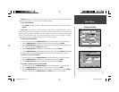
To create a proximity waypoint:
1. Use the ARROW KEYPAD to highlight the fi rst blank line on the Proximity Waypoint List and press
ENTER.
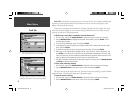
2. The Find Menu appears as described on pages 54-57. Follow the steps provided on those pages
to select the desired waypoint. Once the desired point is selected, you will return to the ‘Proximty’
screen.
3. With the ‘Distance’ fi eld highlighted for the selected waypoint, press ENTER and use the ARROW
KEYPAD to enter the proximity alarm radius. Once the desired alarm radius is selected, press ENTER
again.
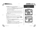
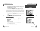
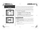
To turn proximity alarms on or off:
1. Use the ARROW KEYPAD to highlight the fi eld at the top of the page, below ‘Proximity Alarm’, and
press ENTER.
2. Select ‘ON’ or ‘OFF’ and press ENTER.
If a proximity alarm circle overlaps with another existing alarm circle, a ‘Proximity Overlaps
Another Proximity Waypoint’ message will appear. If you enter this overlap area, the
GPSMAP 196 will only alert you to the closet proximity point. Use caution when navigat-
ing in these areas.
If temporary fl ight restrictions (TFRs) are issued in your area, the proximity waypoint fea-
ture provides an easy way to designate a no-fl y or restricted fl ight area. Simply designate a
waypoint at the center of the TFR and then an alarm radius. The GPSMAP 196 will provide
and alarm if you enter this area.
Use proximity waypoints to create alarm circles around areas
you wish to avoid. Proximity waypoints can be created for
Jeppesen data (airports or navaids), user waypoints, MapSource
data points, etc.
190-00283-00Backup.indd 74 12/8/2002, 8:09:32 PM