


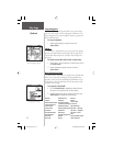
14
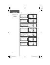
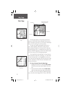
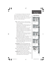
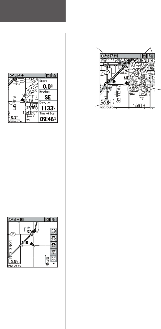
The Map Page displays your present position and
direction of movement using a triangular ‘Position Icon’
that is centered on the map. As you travel the map display
leaves a “trail” (track log) of your movements.
The map also displays geographic details such as
rivers, lakes, highways, and towns. The map shown
above displays a higher level of detail than the basemap
provided with the unit (i.e. residential streets, parks, etc.),
because GARMIN MapSource data has been downloaded
to the unit using a CD-ROM mapping program.
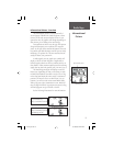
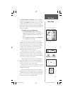
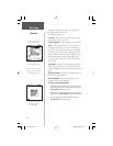
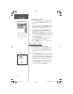
On the right side of the Map Page, you can choose to
show either the Contact Bar (see also pg. 12), Data Fields
or show the Map Only. As you highlight the contacts on
the Contact Bar, the Map page will center the map on that
contact and display its name, direction and distance near
the top of the screen.
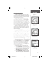
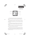
To view a Contact from the Map Page:
1. Highlight the Contact Icon using the CLICK STICK.
Press IN if you want to view the details of the Con-
tact.
2. Press to the LEFT or RIGHT on the CLICK STICK in
order to recenter the map on your current position.
To allow you to view the map from different perspec-
tives, the scale can be changed from 20 feet to 500 miles.
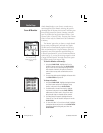
Map Page
Main Page
Status Bar
Option Menu & Main
Page Menu Buttons
Position Icon
Map Scale
Map Page with
Contact Bar
Map Page with Data
Fields
rino120_10.indd 14 9/13/2002, 3:27:41 PM