


Position requests
You may receive a request from a network service to
receive your position information. Service providers may
offer information about local topics, such as weather or
traffic conditions, based on the location of your device.
When you receive a position request, the service that is
making the request is displayed. Select Accept to allow
your position information to be sent or Reject to deny the
request.
Landmarks
With Landmarks, you can save the position information of
specific locations in your device. You can sort the saved
locations into different categories, such as business, and
add other information to them, such as addresses. You can
use your saved landmarks in compatible applications, such
as GPS data.
Select Menu > Applications > Landmarks.
The coordinates in the GPS are expressed using the
international WGS-84 coordinate system.
Select Options and from the following:
New landmark — Create a new landmark. To make a
positioning request for your current location, select
Current position. To select the location from the map,
select Select from map. To enter the position information
manually, select Enter manually.
Edit — Edit or add information to a saved landmark (for
example, a street address).
Add to category — Add a landmark to a category in
Landmarks. Select each category to which you want to add
the landmark.
Send — Send one or several landmarks to a compatible
device. Your received landmarks are placed in the Inbox
folder in Messaging.
You can sort your landmarks into preset categories, and
create new categories. To edit and create new landmark
categories, open the categories tab, and select
Options > Edit categories.
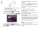
GPS data
Select Menu > Applications > GPS data.
GPS data is designed to provide route guidance
information to a selected destination, position
information about your current location, and travelling
information, such as the approximate distance to the
destination and the approximate duration of travel.
The coordinates in the GPS are expressed in degrees and
decimal degrees format using the international WGS-84
coordinate system.
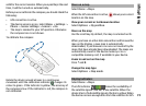
To use GPS data, the GPS receiver of your device must
initially receive position information from at least four
satellites to calculate the coordinates of your location.
When the initial calculation has been made, it may be
possible to continue calculating the coordinates of your
location with three satellites. However, the accuracy is
generally better when more satellites are found.
70
Positioning (GPS)