


Nothing Comes Close to a Cobra
®
87
Mark
Reference point related to Pointer position. Typically it represents by an
icon and label under Mark.
Natural Features
Any topographic feature formed by the action of natural processes:
coastlines, relief, glaciers.
NMEA-0183
The NMEA-0183 Data Interface Standard was developed by the National
Marine Electronics Association of America. It is an international standard
that enables equipment from many different manufactures to be connected
together and share information.
OSGB = Ordinance Survey of Great Britain
Coordinate system describing only Great Britain charts. Generally used
with GBR36 datum, which also describes only Great Britain charts. This
coordinate system cannot be used in any other part of the world.
Pair
Two selectable secondary stations, of a Loran-C chain, which are used to
calculate the TD (Time Difference) position of a point in the map area
covered by the selected Loran-C chain.
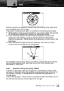
Pictures & Diagrams
The MAX data format allows assigning one or more image to any
cartographic object. These Pictures are typically used to facilitate the
identification of cartographic objects or places around the map: they can
be the landscape layout nearby a harbor, the shape of a bridge or of a
buoy etc. On some objects, such as bridges, the image associated can
represent the Diagram representing the shape of the objects and the
various characteristics (length, height, type of bridge etc.).
Port Info
The Port Info function is a combination of a Port Info database containing
all the relevant Safety and Navigational information normally found in good
pilot books and a presentation software which displays special Port Facility
Symbols.
Ports + Services
Areas along shore with facilities for mooring, downloading and uploading of
ships, generally sheltered from waves and winds. Port installations are
piers, wharves, pontoons, dry docks, cranes... .
Route
Sequence of Waypoints connected by segments (Route Legs). Among the
available Routes, only one is the Active Route, which is shown by a
straight line and arrows to indicate the direction.
Terms