


32
Owner's Manual
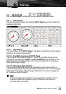
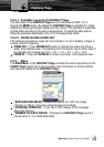
3.6. SUN AND MOON PAGE
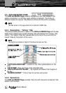
The SUN and MOON Page presents a graphical chart that displays Tide
station information in a 24-hour span starting at midnight. The choice of
different dates and various Tide Stations all around the world is available.
Tide data shown on this page comes from an optional C-CARD data.
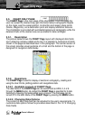
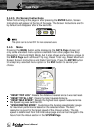
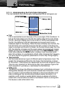
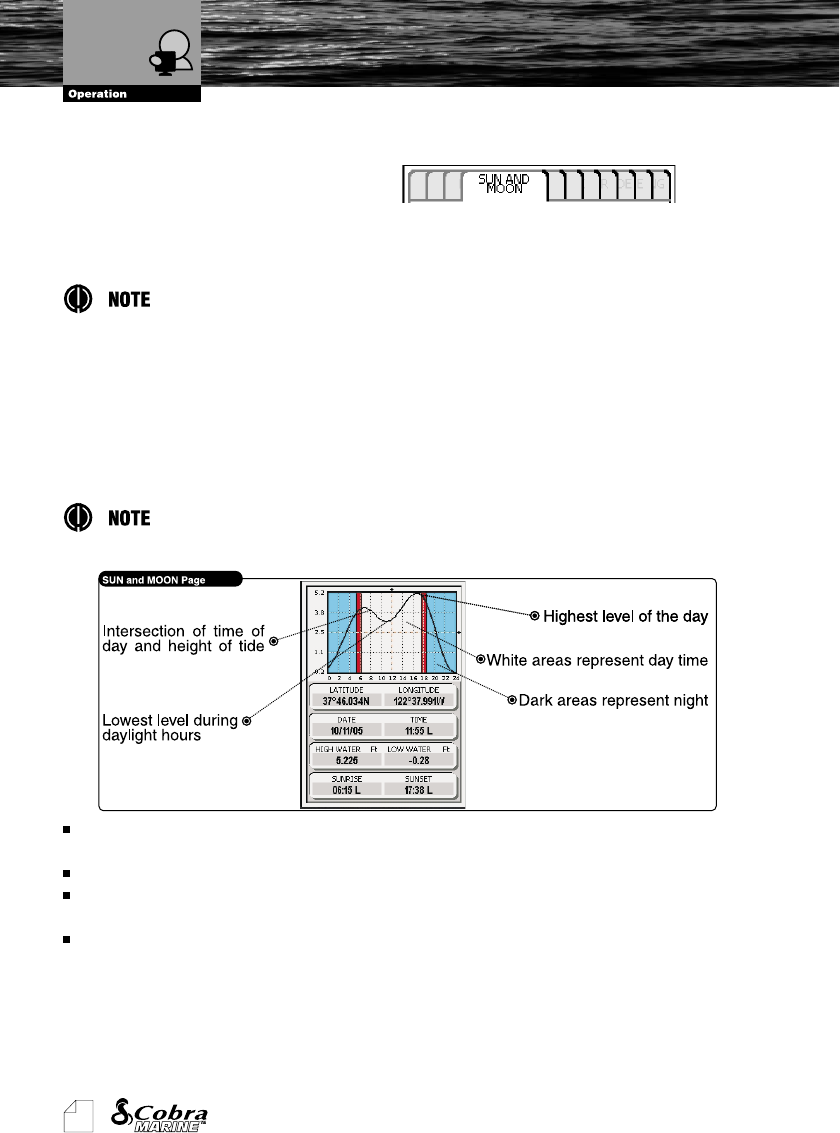
3.6.1. Description - “Telling” Tide
The picture below presents a layout of the SUN and MOON Page with 8 data
fields set by default and a graph showing Tide information from a given Tide
station. The highest Tides are represented by the top of the curve and the
lowest Tides by the bottom of the curve.
Tide heights are indicated at height of Tide above the mean low Tide.
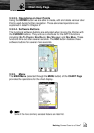
“LATITUDE/LONGITUDE”: Location of the Tide symbol/station on the
chart.
“DATE/TIME”: Date and Time of the indicated data.
“HIGH WATER/LOW WATER”: The highest and lowest Tide heights of
the day.
“SUNRISE/SUNSET”: Time of day for sunrise and sunset.
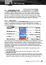
3.6.2. Operations
The SUN and MOON Page provides Tide Info with relevance to desired Tide
Station and Location.
Sun and Moon Page