


62
Owner's Manual
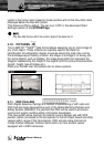
may be projected in perspective mode during navigation. The upper side of
the map is more compressed than the lower side, a wider map area is
visible. The perspective view allows showing more chart information
immediately ahead and around the Pointer.
“COLOR PALETTE”: See previous Par. 5.2.1.
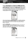
“COURSE VECTOR”: Graphical indication of the direction in which the
Vessel is heading. The Course Vector origin is the vessel’s position so the
time line movement is synchronized with the vessels Icon. Course Vector
"course" is given by the value of COG (Course Over Ground) and its length
is proportional to the SOG (Speed Over Ground). The length of the
prediction line is controlled by selecting OFF, 2, 10, 30 MIN, 1 HOUR, 2
HOURS, INFINITE.
“BUOYS ID”: Turns ON or OFF the displaying of the Buoy number. To
better identify the Buoys, it is possible to show the name/number of the
buoys next to the icon on the chart.
“CHART POINT NAMES”: Turns ON or OFF the displaying of the Names
(local area names).
“NAV AID PRESENTATION”: Sets the Nav Aid presentation as US or
INTernational. When selected it affects Lights, Signals, Buoys & Beacons
display. INTernational: Draws Nav-Aids using international symbology. US:
Draw Nav-Aids using NOAA symbology. All components of Complex
Objects are shown.
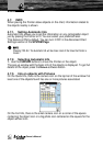
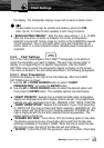
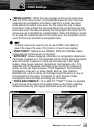
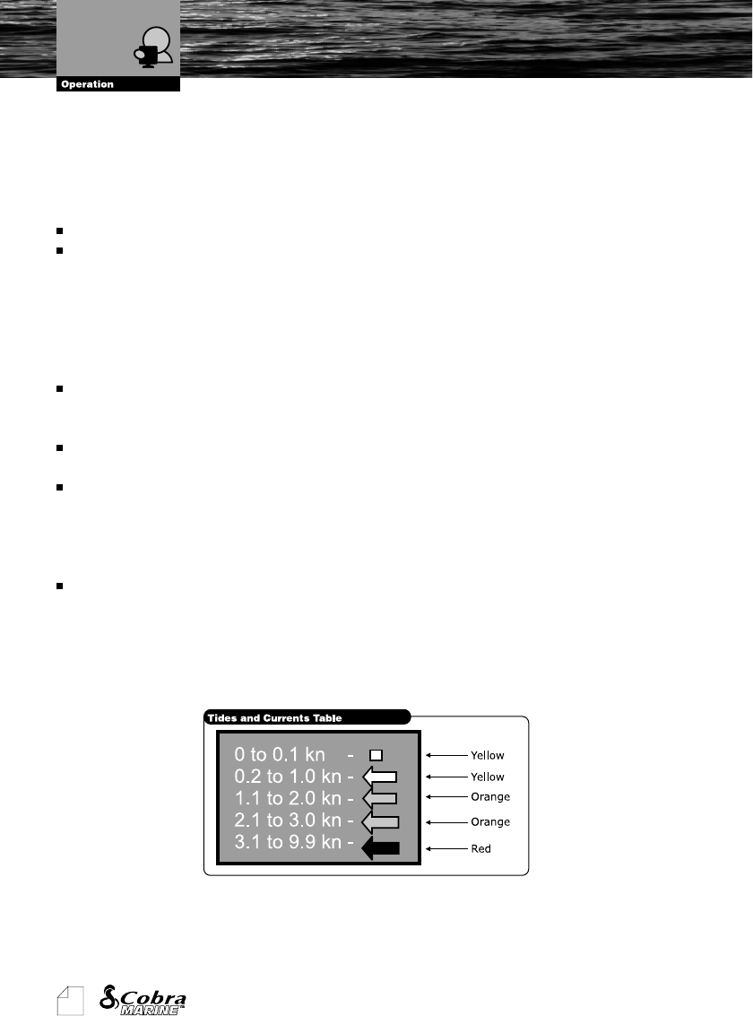
“TIDES AND CURRENTS”: Turns ON or OFF the displaying of the Tides
and Currents. The new worldwide database with tidal stream information is
now available with C-MAP NT MAX
TM
C-CARDs. When DATA/TIME is
available, Tidal stream arrows are shown on the charts, indicating the
direction and strength of the Tide. The colour of the arrow denotes the
strength of the current as follows:
When the chartplotter receives a valid position fix, the Tide icons are
shown on the charts on the basis of the current date and time. The arrows
on the screen will rotate and change color and length as the direction and
Chart Settings