


64 A65 GPS Chartplotter
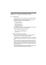
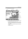
4.4 The Chartplotter Display
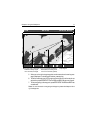
The chartplotter includes features that enable you to interpret your surroundings
and make informed decisions based on your location. You can:
• View details of specific cartographic objects (see “Cursor Info“ on page 23)
• Reduce the level of cartographic detail shown on the chart (see “Chart Setup
Menu“ on page 27) and “Simplifying the Information on the Chart (Declut-
ter)“ on page 66)
• View details of available port services for a selected port (see “Port Services“
on page 91)
• View tide data (see page 92)
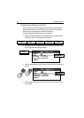
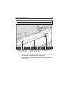
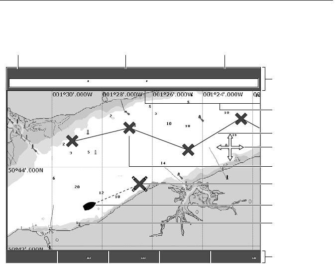
6.0nm North-Up (Relative Motion)
Csr Pos N 50°45.160 W 001°23.497 065°T 4.1nm
GULLY RIDGE
CREEK POINT
PORTSIDE
PORT POINT
WPT 0005
Chart boundary
Chart range
Chart orientation
Motion mode
Status bar
Cursor
Route
Waypoint
Current position
Cartographic object
Active waypoint
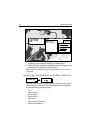
Soft keys
D7909-2
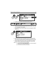
FIND SHIP GOTO ROUTES TRACKS PRESENTATION
FIND SHIP ROUTES TRACKS PRESENTATION
GOTO