


9
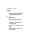
Chapter 1: Using the Display
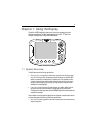
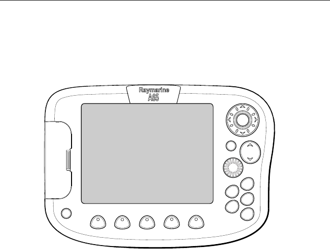
The A65 is a GPS Chartplotter display unit that can be upgraded to include
fishfinder capabilities. The A65 comes equipped with a 6.5" TFT 256 Color
Sunlight Viewable Color LCD and RS12 GPS Sensor.
1.1 System Overview
The A65 features the following applications:
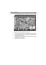
• Chartplotter for navigation information, waypoint entry and route-plan-
ning. For full functionality, the display requires connection to the RS12 GPS
sensor (included) for the acquisition of position data. This application also
requires a relevant chart card to obtain detailed information for the area in
which you are navigating. Optionally, you may connect a compass via the
NMEA port for heading data.
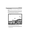
•
Fishfinder to build a picture of what is below your vessel, display bottom
structure and to help find and identify targets such as fish and wrecks.
This application also requires an optional DSM25 Digital Sounder Module and
a suitable transducer.
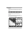
Also available are various data screens that are displayed in separate split screen
windows alongside the Chart and Fishfinder applications:
•
Nav Data for viewing position information as well as current time, date and
depth information.
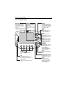
D7714-1
PAG E
ACTIVE
DATA
MENU
WPTS
MOB
CANCEL
PWR
ENTER
RANGE