


66 A65 GPS Chartplotter
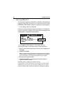
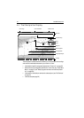
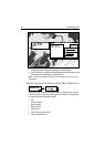
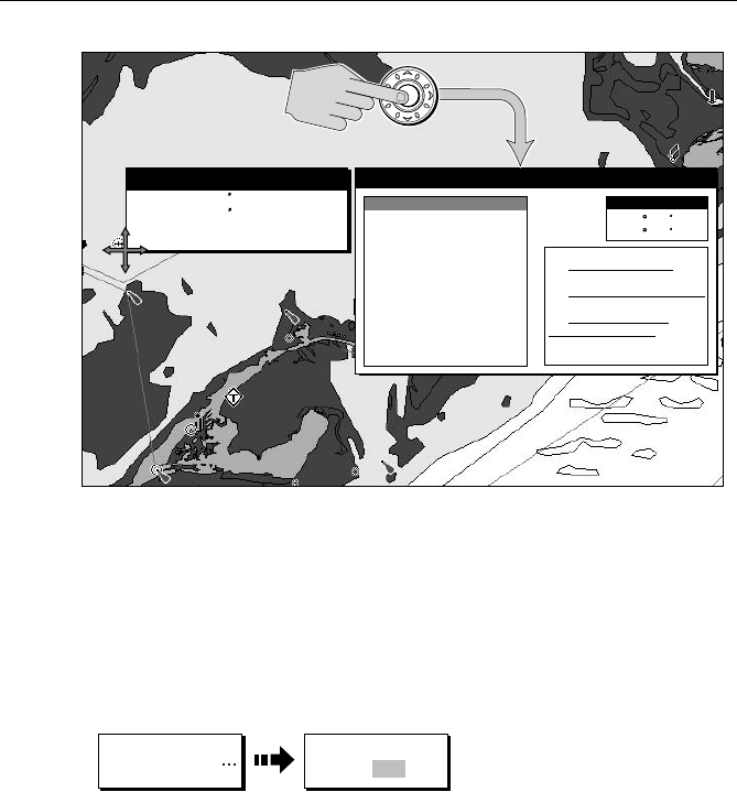
3. If you desire more detailed information, press ENTER. The Object Info box is
re-displayed giving further details relating to the selected object.
4. In the left-hand box, highlight the desired subject area for the object you have
selected. Details are displayed in the right-hand box.
Note:
To scroll through detailed information, use the trackpad to move control to the
right-hand box.
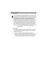
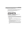
Simplifying the Information on the Chart (Declutter)
If there are a large number of cartographic objects in a particular area, you can
reduce the amount of detail by de-cluttering the chart display. Turning declutter
on hides the following cartographic objects:
• Text
• Chart boundaries
• Spot soundings
• Depth contours
• Light sectors
• Caution & routing information
• Land and marine features
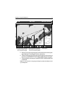
N 25° 18.160
W 080° 19.397
Wreck
Object Information
D8881-2
N 25 18.160
W 080 19.397
Object Information
Category of wreck
Dangerous wreck
Vertical datum
Mean lower low water
Water level effect
Always under
Date
11/12/05
Position
Wreck
Depth area
Control zone
Restricted area
water/submerged
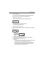
ENTER
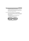
PRESENTATION
D8088-2
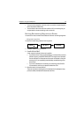
DECLUTTER
ON OFF