


:
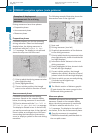
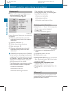
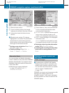
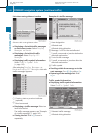
Blocked route section
;
Current vehicle position; the triangle
indicates the vehicle’s direction of travel
=
Information about the blocked route
section
i
Blocked route section : is always
highlighted in red/white. The information
about blocked route section = shows
which section of the route is blocked and
the length of the blocked section.
X
Starting route calculation: Select Start,
see also (Y page 120).
X
Deleting blockage: Select Navi Q
Route Q Detour Q Delete.
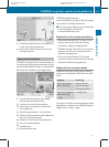
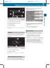
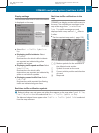
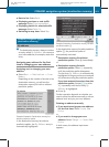
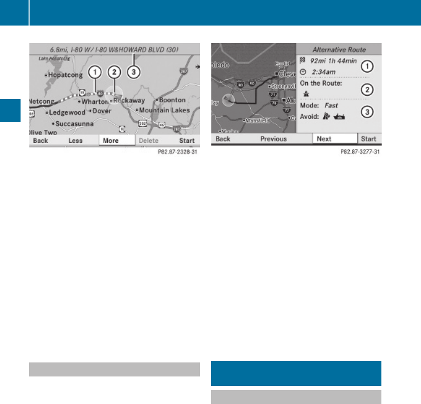
Alternative Route
You can calculate and display alternative
routes in addition to the route that COMAND
displays automatically. The original route is
displayed in light blue while the alternative
route is dark blue.
X
With the menu system displayed
(Y page 102), select Route Q
Alternative Route.
:
Route distance, time, and time of arrival
for the currently selected alternative
route marked in deep blue
;
On the Route: Symbols indicate special
parts, such as tunnels, ferries or toll
roads, on the displayed alternative route.
=
Mode: Current settings for the displayed
alternative route
Avoid: Symbols of route parts to avoid,
for example tunnels, ferries or toll roads
X
Displaying/selecting other alternative
routes: Select Previous or Next.
X
Accepting the currently selected, deep
blue route for route guidance: Select
Start.
COMAND navigation system (real-
time traffic)
Traffic messages
i
A subscription to SIRIUS XM Satellite
Radio service provider is required for the
satellite radio reception referred to here.
You can find more information on satellite
radio in chapter “Satellite Radio”
(Y page 170).
COMAND can receive and incorporate traffic
messages via satellite radio into the
navigation system. Traffic report messages
and map symbols can then be viewed in the
COMAND display.
138
COMAND navigation system (real-time traffic)
Control systems
221_AKB; 6; 20, en-US
d2ugruen, Version: 2.11.8.1
2009-09-24T13:28:17+02:00 - Seite 138