


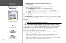
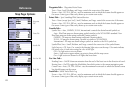

• ELEVATION – Elevation above/below MSL (Mean Sea Level)
• ETA AT DESTINATION – Estimated Time of Arrival to final waypoint
• ETA AT NEXT – Estimated Time of Arrival to next waypoint
• GPS ACCURACY – Shows estimated GPS accuracy
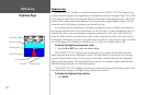
• HIGHWAY – Smaller version of the Highway Page
• MAXIMUM SPEED – Fastest speed the unit has traveled
• MOVE AVERAGE SPEED – Average moving speed
• MOVE TRIP TIME – Time unit has been moving for a trip
• OFF COURSE – Distance from desired track
• POINTER – Arrow points to your destination
• POSITION – Current position coordinates
• SONAR* – Compressed view of sonar data
• SPEED – Speed over ground
• TIME OF DAY – Current time
• TIME TO DESTINATION – Time to final waypoint
• TIME TO NEXT – Time to next waypoint
• TO COURSE – Bearing to desired track
• TOTAL AVERAGE SPEED – Total average speed
• TOTAL TRIP TIME – Total travel time of trip, stopped and moving
• TRACK – Current compass direction of travel
• TRIP ODOMETER – Trip Odometer
• TURN – Directional amount of turn needed to match bearing
• VELOCITY MADE GOOD – Velocity Made Good to destination
• VOLTAGE – Current voltage reading being received by unit
• WATER SPEED* – Speed through the water
• WATER TEMP. LOG* – Timeline graph of the transducer’s temperature reading.
• WATER TEMPERATURE * – Water temperature
*If receiving proper sonar data from other device, such as a GSD 20 Sounder Module or NMEA device.
NOTE: COMPASS, HIGHWAY, POSITION, SONAR, and WATER TEMP. LOG are only available on Large and Huge
sized data fields.
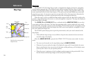
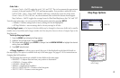
• Turn Declutter On/Off — toggles between showing spot soundings and map outlines for easier
viewing.
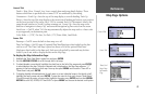
Choose the type of data
you wish to display.
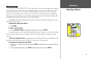
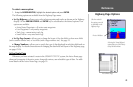
Map Setup
Menu Options
26
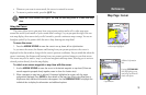
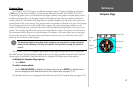
Reference
Map Page Options