


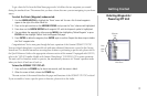
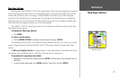
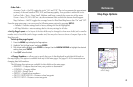
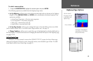

Other Tab—
Accuracy Circle— On/Off: toggles the circle “On” and “Off”. The circle represents the approximate
accuracy of the unit based on EPE, DOP, and basemap quality. Your position is within the circle.
Lat/Lon Grid— Text— None, Small, Medium, and Large: controls the screen size of the name.
Zoom— Auto, Off, 20 ft.-800 mi.: sets the maximum scale at which the feature should appear.
Map Outlines— On/Off: toggles the coverage boxes for BlueChart/MapSource data “On” and “Off”.
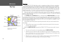
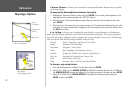
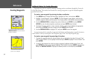
From the map setup page, you can access the following menu options by pressing
MENU:
• Defaults— restores settings back to factory settings for the tab highlighted.
• All Map Defaults— restores settings back to factory settings for all tabs.
• Set Up Page Layout — the layout of the data fields may be changed to show more fields (with a smaller
number size) or less fields (with a larger number size).You may also choose to show a Compass Tape on the
Map Page only.
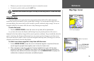
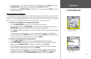
To set up the page layout:
1. Press the MENU key to display the Page options.
2. Highlight ‘Set Up Page Layout’ and press ENTER.
3. The current setting displays, press
ENTER to change. Use the ARROW KEYPAD to highlight the desired
setting, then press
ENTER.
4. Press
QUIT when finished.
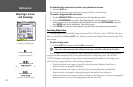
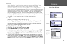
• Change Numbers — allows you to specify the type of data displayed in each data field used on
the map display. This option is available from any of the main pages. See pages 25-26 for instructions on
changing data field numbers.
The following data options are available for data fields on the main pages:
• BEARING – Compass direction from your position to destination
• COMPASS – Compass ribbon
• COURSE – Desired Track
• DEPTH* – Depth below transducer
• DIST TO DESTINATION – Distance to final waypoint
• DIST TO NEXT – Distance to next waypoint
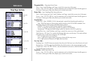
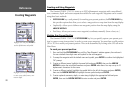
Other Tab
Highlight the field you
wish to change
25
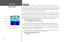
Reference
Map Page Options