


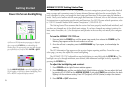
Now that we’re navigating to an actual destination, let’s move on to the GPSMAP 172/172C naviga-
tion pages by pressing the PAGE key three times. (When using the GPSMAP 172/172C in simulator
mode, the optional GSD 20 Map/Sonar Page and Sonar Page are displayed (see page 8)
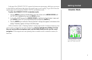
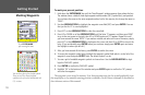
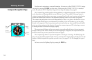
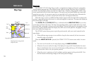
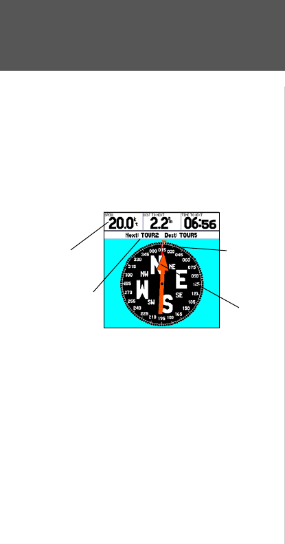
The Compass Page provides graphic steering guidance to a destination waypoint, with an emphasis
on the bearing to your destination and current direction of travel. The middle of the page features a
rotating ‘compass ring’ that shows your course over ground (track) while you’re moving, and a bearing
pointer that indicates the direction of the destination (bearing) relative to the course over ground.
The compass ring and pointer arrow work independently to show—at a glance—the direction of your
movement and the direction to your destination. For instance, if the arrow points up, you are going
directly to the waypoint. If the arrow points any direction other than up, turn toward the arrow until it
points up—then continue in that direction. Because the compass rings uses GPS technology, you must
be moving in order for the track to display properly.
The current speed, distance to the next waypoint, turn angle and and time to the next waypoint
display at the top of the screen. When you are not navigating to a waypoint, the compass shows your
direction of travel as you move, but the arrow does not appear.
The Compass Page allows for precision navigation to one degree of steerage. The default page dis
-
plays one row of medium numbers fields. You may customize the Compass Page to display the size and
number of fields along with the type data you wish to see. (See pages 25-26) for changing the types of
data.)
Let’s move on to the Highway Page by pressing the PAGE key.
Compass Page
Current
Destination
Data
Fields
Compass
Ring
Pointer
Arrow
14
Getting Started
Compass Navigation Page