


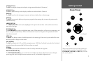
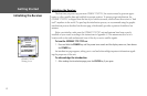
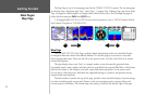
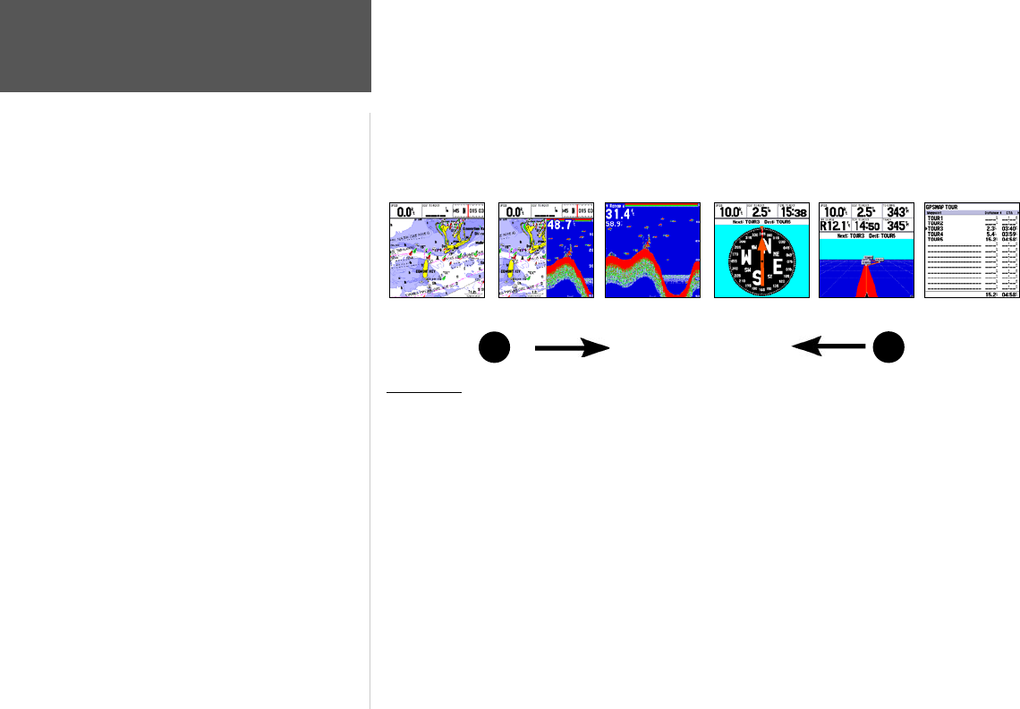
The Map Page is one of six main pages used in the GPSMAP 172/172C’s system. The six main pages
are the Map Page, Map/Sonar Split Page*, Sonar Page* , Compass Page, Highway Page, and Active Route
Page. All pages are linked together in a simple chain, which allows you to scroll through the pages in
either direction using the PAGE
and QUIT keys.
(* If equipped with GSD 20. For GSD 20 sonar related operations, refer to “GSD 20 Sounder Module
with Garmin Chartplotters” (190-00241-03))
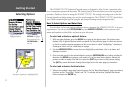
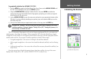
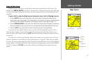
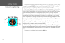
Map Page
The GPSMAP 172/172C’s Map Page combines digital chartplotting with a user-selectable display
of navigation data and a built-in worldwide database. It is also the page you use most to create and
edit waypoints and routes. Before we take off on our practice route, let’s take a brief look at its various
features and displays.
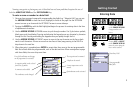
The map display shows your “boat” as a triangle marker on an electronically generated chart.
Geographic names, roads, markers and buoys that are provided by the optional BlueChart or MapSource
data are also shown. It also displays your track, routes and nearby waypoints. An on-screen cursor
lets you pan to other map areas, determine the range and bearing to a position, and perform various
waypoint and route functions.
The data window, located at the top of the page, provides a user-selectable display of various naviga
-
tion data, including speed over ground, distance to the next navigation point, compass ribbon and
current position coordinates. The current map scale setting is located at the bottom right of the page.
PAGE
QUIT
Active Route Page
Highway Page
Map Page
Compass Page
Map/Sonar Split Page
Sonar Page
8
Getting Started
Main Pages/
Map Page