


GPS Receiver
Reference
SECTION 6
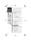
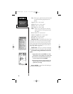
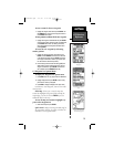
City - allows you to control text size and zoom levels
at which the following map features will
display.
Large City: Text - Zoom control
Medium City: Text - Zoom control
Small City: Text - Zoom control
Small Town: Text -Zoom control
Other - allows you to control text size and zoom
levels at which the following map features
will display.
Rivers, Lakes: Text - Zoom control
Latitude - Longitude: Text - Zoom control
Metro Areas—Text: Zoom control
Railroads—Text: Zoom control
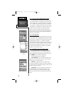
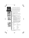
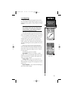
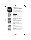
Map Source Info - This page lists the names of up
to 25 maps used as the source for the GPS map pages
and allows you to activate or deactivate maps of your
choice. These maps will not be listed unless they have
been loaded using one of the devices listed in the I/O
Setup page. (Refer to page 100.)
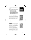
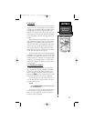
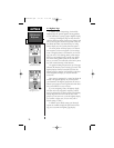
Measure Dist - allows you to measure the bearing
and distance between any two points on the map display.
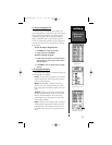
To measure bearing and distance between two
points:
1. Highlight Measure Dist and press ENTER. An on-screen
pointer appears on the map display at your present position.
2. Move the cursor to the desired reference point (the point
you want to measure from) and press ENTER.
3. Move the cursor to the point you want to measure to. The
bearing and distance from the reference point will be dis-
played at the top of the page.
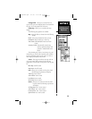
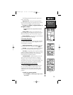
Restore Defaults - resets all data field headings to
their factory default settings.
70
Map Page Options, Setup
and Map Source Menus
Measuring Distance
NvTlkGPS.qxd 2/1/00 4:13 PM Page 10