


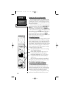

GPS Receiver
Reference
SECTION 6
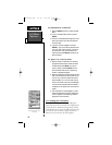
Entering Data and Accessing Programming:
Before you begin to explore the capabilities of the
GPS receiver, learning how to navigate in the GPS pro-
gramming will allow you to take advantage of the fea-
tures. It will accelerate your comprehension of how the
GPS receiver functions.
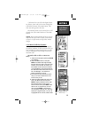
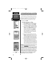
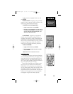
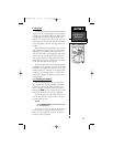
There are three keys that allow you to access pages,
menus and enter data. These are the PAGE, MENU and
ENTER keys. Movement from field to field within a
screen display is accomplished using the ARROW Rock-
er Pad. Use the arrows to cursor to and highlight a field
on the display then press ENTER to either enter data or
select from a “pop up” menu. You can use either the
phone keypad alpha-numeric keys or the ARROW
Rocker Pad to enter data in a field. Use the QUIT key to
cancel any entry before it is completed.
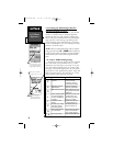
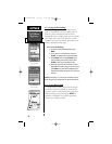
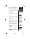
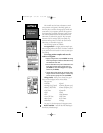
6.1 Satellite Status Page
The NavTalk’s Satellite Status Page provides a visual
reference of various GPS receiver functions, including
current satellite coverage, receiver operating mode, bat-
tery level and position accuracy. As the receiver locks
onto satellites, a signal strength bar will appear for each
satellite in view, with the appropriate satellite number
(01-32) underneath each bar. The progress of satellite
acquisition is shown in three stages:
• No signal strength bars—the receiver is looking
for the satellites indicated.
Hollow signal strength bars—the receiver has
found the satellite(s) and is collecting data.
Solid signal strength bars—the receiver has col-
lected the necessary data and the satellite(s) is
ready for use.
Once a fix has been calculated, the NavTalk will
then update your position, track, and speed by select-
ing and using the best satellites in view.
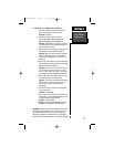
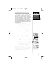
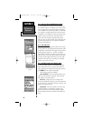
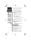
6.1.1 Sky View and Signal Strength Bars
The satellite sky view shows a bird’s-eye view of
the position of each available satellite relative to the
unit’s last known position. The outer circle represents
the horizon (north up); the inner circle 45º above the
horizon; and the center point directly overhead.
You can use the sky view to help determine if any
satellites are being blocked, and whether you have a
62
The Three Stages of
Satellite Acquisition
NvTlkGPS.qxd 2/1/00 4:13 PM Page 2