


SECTION 6
GPS Receiver
Reference
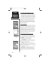
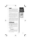
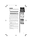
6.3 Map Page
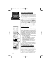
The NavTalk features a powerful real-time moving
map that does more than plotting a course and route.
The Map Page also displays background detail, includ-
ing geographic names, lakes, rivers, coastlines and
highways. An on-screen cursor lets you pan ahead to
nearby waypoints, determine the distance and bearing
to any map position, and mark new waypoints as you
navigate.
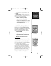
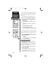
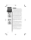
The NavTalk also features dedicated zoom keys for
instant zooming (see page 9). The map portion of the
page displays your present position as a pointer icon,
with your track and/or route displayed as small points
on the screen (an electronic bread crumb trail, if you
will). Nearby waypoints are represented with names
and symbols. You may select which features are shown
via the Map Page Options (see page 68).
The data window above the map displays the time
and distance to next waypoint, plus your current speed
(all defaults). A bearing pointer lets you know if you’re
heading toward your destination. (If the pointer points
straight up, you’re heading directly to it.) Each data
field may be configured to display any one of twenty-
four data options.
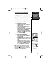
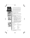
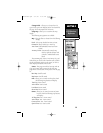
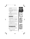
6.3.1 Zooming and Panning
There are three main functions you can perform
from the Map Page: zooming, panning, and pointing.
The map has 24 map scales (from 120 feet to 500
miles, or 30 meters to 800 km) which are selected by
pressing the ZOOM keys. The current map scale is indi-
cated in the bottom left corner of the map display.
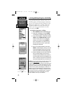
You can also pan on the map which allows you to
move the map with the keypad in order to view areas
beyond the current map.
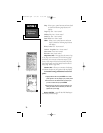
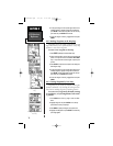
To pan:
1. Use the ARROW KEYPAD to move the map in any direc-
tion, including diagonally.
As you begin to pan on the map, an arrow appears.
The arrow serves as a “target marker” for the map.
When the arrow is placed on an object, the name of
that object will be highlighted.
Map Page
67
NvTlkGPS.qxd 2/1/00 4:13 PM Page 7