


14
15
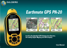
Inthescenariobelow,Tom,abirdwatcher,usestheEarthmateGPSPN-20,aerialimagery,andthe
EarthmateGPSPN-20OnlineMapCentertoprepareforhisexpedition.
Before Tom leaves for his trip, he uses the Earthmate GPS PN-20 Online Map Center to download
additional map data so he can get satellite and aerial views of the area where he’ll be. This is helpful
to Tom because he has heard that the bird population is greater near the swamp land. With the aerial
and satellite data available from the Online Map Center, Tom can see the geological formations in his
bird watching area before he leaves, giving him a greater idea of where he should spend his day.
1. Visit http://data.delorme.com to download the area where you will be bird watching.
Once the map of the location is saved on the Earthmate GPS PN-20, Tom leaves for his bird watching
trip. When he arrives at the location, he parks his truck, turns on the Earthmate GPS PN-20, waits
until he gets a 2-D or 3-D fix, places a waypoint to represent the parking lot, modifies his tracking
settings, and then turns on Track recording.
2. Press and hold the Power button to turn on the Earthmate GPS PN-20.
3. Press the Mark button on the device to place a waypoint at the parking lot location and press
ENTER.
Note: To choose a different symbol, scroll to the top of the Waypoints screen to highlight the
waypoint symbol and press ENTER. Use the arrow keypad to find and highlight the symbol you
want.
4. Press MENU, highlight the Tracks option, and press ENTER.
5. Press MENU, highlight the Edit Track Settings option, and press ENTER.
6. Highlight the Record Points By drop-down list and press ENTER.
7. Highlight the Time option and press ENTER.
8. Highlight the Recording Interval text field and press ENTER. Use the arrow keypad to increase/
decrease each digit. Press ENTER after each digit is changed.
9. If the On button is not activated, highlight the button and then press ENTER to activate it.
OR
If the On button is already activated, go to step 10.
Tom continues his journey to the bird-watching spot. While he’s walking, he notices an eagle in a tree
and wants to use his Earthmate GPS PN-20 to mark a waypoint at the bird location.
10. While at the spot of the tree, press the Mark button.
11. Scroll to the top of the Waypoints screen to highlight the waypoint symbol and press ENTER.
Use the arrow keypad to find and highlight the bird icon and press ENTER.
12. Scroll to the label text field (to the right of the bird icon) and press ENTER. Use the arrow key
pad to highlight the letter E and press ENTER. Repeat this step for each letter in the word
“Eagle.” When you’re finished, highlight OK and press ENTER.
13. Scroll to highlight the Save button and press ENTER.
When he arrives at the desired bird watching spot, he saves his track log, turns off the GPS device,
and spends the day bird watching.
14. Press MENU, select Tracks, and press ENTER.
15. Scroll to highlight the Save button and press ENTER.
16. Press the Power button to turn off the Earthmate GPS PN-20. Press ENTER when prompted.
When he’s finished for the day, he turns the GPS device back on, waits until he gets a 2-D or 3-D fix,
and then follows his track to where he started—ensuring he won’t get lost. The process of following
his initial track creates a new route that he can use to navigate back to the parking lot.
17. Press and hold the Power button to turn on the Earthmate GPS PN-20.
18. Press MENU, select Tracks, and press ENTER.
19. Select the track that was saved earlier that day and press ENTER.
20. Scroll to highlight the Follow button and press ENTER.
Tom follows the route directions on the map screen and reaches his start location without getting lost.
Mountain Biking
TheEarthmateGPSPN-20isalsoaperfectcompanionwhilemountainbiking.
Carla and Jordan are preparing for a ride at Slickrock Bike Trail. Before they go, they download data of
the Moab, Utah, region with their compatible DeLorme software program. They create a route that
starts and finishes at the trailhead and includes three stops: Shrimp Rock, Upper Shrimp Rock, and
Mt. View Cave. Then they export the data of the region, as well as the route they created, to their
Earthmate GPS PN-20. Once they arrive at the trail, they mount their GPS devices onto their bikes,
Scenarios
Safety Tip: Besuretobringa
map and compass with you on
your expedition in case the bat-
teries inyourEarthmateGPS
PN-20 are low.
Tip: Use the Time option if you
want to record a lot of detail.
Use the Distance option if you
are going to make many steps
along the way.
Editingthetracksettings
Markingthe“Eagle”waypoint