


6
7
GPS PN-20 vary by application. For more information, see the mapping application’s Help
system for instructions on sending maps to your Earthmate GPS PN-20.
• Online Map Cutter for Earthmate GPS PN-20—Visit http://data.delorme.com. You must have
an Internet connection to use this website. For instructions on sending maps to your Earthmate
GPS PN-20 with this online application, see the Online Map Cutter for Earthmate GPS PN-20
Help system.
You can transfer many types of data, such as satellite imagery, aerial imagery, USGS Topo Quad
maps, NOAA nautical charts, and more. Save maps in internal memory or on a removable memory
(SD) card in the Maps directory.
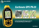
Step 5 — Use the Pages to Track, View Your Position While You Travel, and More
This manual describes all of the functions found in each page on the Earthmate GPS PN-20. See the
Table of Contents to find the headings that are most important to you.
About GPS
What is GPS?
The Global Positioning System (GPS) applies modern technology to the ancient art of navigation.
The U.S. Department of Defense has developed and launched a series of positioning satellites in an
orbiting “constellation.” These satellites are used as reference points much the same way stars have
been used in conventional navigation.
Using these satellites, a GPS receiver can determine your position anywhere on the globe. GPS pro-
vides accurate information about coordinate position, elevation, speed, and direction of travel. Many
people have discovered the benefits of GPS for recording tracks and much more.
How Does GPS Work?
The GPS constellation consists of at least 24 satellites, each carrying several atomic clocks to ensure
the most accurate time possible. The satellites broadcast low-power radio waves containing the sat-
ellite’s identity code and the exact time (to the nanosecond) that the message was sent.
When a GPS receiver picks up a satellite signal, it identifies the satellite and compares the signal time
with its own clock. The time difference represents the time it has taken for that radio wave to travel
from the satellite to the receiver. Since radio waves travel at the speed of light, the time difference
can be used to calculate the distance from the satellite to the GPS receiver.
The satellite’s identity code provides the location of the satellite, and the distance to the receiver
creates a sphere of possible locations for the GPS receiver. Without more information, the receiver
knows only that it is located somewhere on that sphere.
Two additional satellites are necessary to narrow down the receiver’s position. Each of these satel-
lites sends a similar radio message containing time and identity information. The GPS receiver checks
the orbital location of each satellite and uses the elapsed time to create two additional spheres of
possible locations. These three spheres intersect at two points; however, one of these points is elimi-
nated because it is far away from the Earth’s surface. Therefore, the second point is assumed to be
correct. The data from these three satellites provides the receiver with a two-dimensional location.
Data acquired from a fourth satellite pinpoints the receiver’s exact location. This additional positioning
information allows the GPS receiver to calculate its elevation, which is particularly important for GPS
users in mountainous locations.
GPS Position Accuracy
Any buildings, natural structures, or heavy foliage that obstruct the GPS antenna’s view of the sky
prevent satellite signals from reaching the receiver and decrease the accuracy of your position.
Frequently Asked Questions
Can I install non-DeLorme maps on the Earthmate GPS PN-20?
DeLorme’s professional GIS software, XMap
®
, allows you to register non-DeLorme maps and
transfer them to the Earthmate GPS PN-20.
How can I improve the life of my batteries?
When the backlight is on, it consumes a large part of the battery. Changing the backlight timer to turn
off after 15 seconds could double the life of your batteries. For information on changing the backlight
timer, see ToModifytheBacklightTimer on page 68.
Other ways to increase the life of the batteries include:
• Removingyourbatteriesforlong-termstorage
Getting Started
Note: Large maps may take
longer to transfer to the device.
Tip: While it is faster to access
maps that have been saved to
internal memory, the quickest
way to transfer maps to your
deviceistocopythemaples
to an SD card with an SD card
reader.
Note: Placing the Earthmate
GPSPN-20inabackpackpock-
et or jacket should not result
inproblemswithGPSposition
accuracy.