


overlap and clutter the chart. If several logs of the same
area are required, the maps should be put on separate
microSD cards.
StructureMap tips
• To get a picture of taller structures (a wreck, etc.) — do not
drive over it, instead, steer the boat so the structure is on the
left or right side of your boat.
• Do not use Autorange when using StructureScan. Set your
structure range to a significantly greater level (two-to-three
times) than the water depth to ensure a complete scan and to
maximize conversion accuracy.
• Do not overlap history trails when conducting a side-by-side
scan of an area.
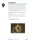
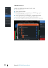
Recording StructureScan data
StructureScan data can be recorded from a chart panel with
Structure overlay enabled.
StructureScan recordings can also be started from a StructureScan
panel.
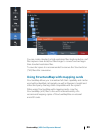
When StructureScan data is being recorded, there is a flashing red
symbol and a message appears periodically at the bottom of the
screen.
Ú
Note: The message includes information about file size.
Keep the size of your logs to 100MB or less to allow for
faster file conversion.
The recording is stopped by re-selecting the record function.
Converting StructureScan data to StructureMap format
A StructureScan log file (.sl2) is converted to StructureMap format
(.smf ) after recording from the recording dialog, or from the files
browser.
88
StructureMap | HDS Gen3 Operator Manual