


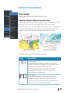
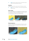
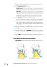

Vessels’ extension lines
Sets the lengths of the heading and course extension lines for your
vessel. For setting extension line lengths on other vessels shown as
AIS targets, refer to AIS "Course extension lines" on page 125.
A: Heading
B: Course Over Ground (COG)
The lengths of the extension lines are either set as a fixed distance,
or to indicate the distance the vessel moves in the selected time
period. If no options are turned on for the vessel then no extension
lines are shown for your vessel.
Your vessel heading is based on information from the active
heading sensor and the COG is based on information from the
active GPS sensor.
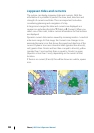
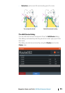
Synchronize 2D/3D chart
Links the position shown on one chart with the position shown on
the other chart when a 2D and a 3D chart are shown side by side.
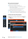
Pop-up information
Selects whether basic information for chart items is displayed when
you select the item.
Grid lines
Turns on/off viewing of longitude and latitude grid lines on the
chart.
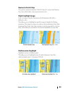
Hide chart
If the option is set to ON when viewing a Lowrance chart, the chart
(background) is not displayed and only the vessel, extensions,
waypoints, and routes are displayed on a white background.
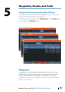
Waypoints, Routes, Trails
Turns on/off displaying of these items on chart panels. Also opens
the Waypoints, Routes and Trails dialogs you can use to manage
them.
48
Charts | HDS Gen3 Operator Manual