


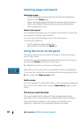
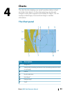

Key Description
8 Chart range scale
9 Range rings interval (only displayed when Range rings are
turned on)
* Optional chart items
Ú
Note: You turn the optional images on/off individually. For
more information, see "Chart settings" on page 47.
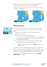
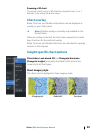
Chart data
The system is delivered with different embedded cartography
depending on region.
All units support Insight charts from Navico including Insight
Genesis. The system also supports Navionics Gold, Platinum+ and
Navionics+, C-MAP MAX-N/MAX-N+ by Jeppesen as well as content
created by variety of third party mapping providers in the AT5
format. For a full selection of available charts please visit
insightstore.navico.com, c-map.jeppesen.com or navionics.com.
Ú
Note: Insight charts are referred to as Lowrance in the
menu.
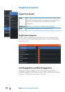
Charts on microSD cards are shared over the Ethernet network, so
only one chart card per vessel is required.
Ú
Note: The system does not automatically switch to
embedded cartography if the chart card is removed. A low-
resolution chart will be displayed until you re-insert the
card or manually switch back to the embedded
cartography.
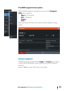
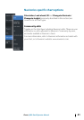
Showing dual chart types
If you have different chart types available - embedded, in the card
slot, or on the Ethernet network - you can show two different chart
types simultaneously on a page with two chart panels.
You can select a dual chart panel by pressing and holding the Chart
application button on the Home page, or by creating a favorite
page with two chart panels.
34
Charts | HDS Gen3 Operator Manual