


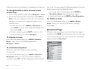
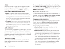
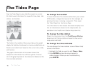
72
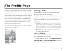
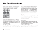
The Pro le Page
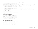
Scale
Switching the type of scale used to measure changes
in elevation gives you different views of the graph.
To change the scale type, go to MENU > Switch to
Static Scale or Switch to Dynamic Scale.
Static–The static scale adjusts the pro le graph
based on the maximum and minimum elevation; the
same graph scale is maintained for the entire track,
letting your compare current elevation to the rest of
your trip. This is the default view .
Dynamic–The dynamic scale adjusts based on the
visible maximum and minimum zoom levels. As you
pan the graph or zoom in or out, the graph changes
to give you the best view.
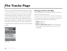
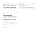
GPS Indicator
The GPS location is indicated by a green dot on the graph
when you are within 100 feet of the track. The dot is in
the center of the crosshair (unless you are panning along
the pro le). A red dot indicates there is no GPS x within
100 feet of the track you are pro ling.
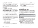
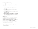
To pro le a track
To view a pro le for the active track, open the Pro le
Page. Track recording must be turned on to view an
active pro le.
To view a pro le for a saved track, from the Pro le Page,
go to MENU > File > Open. Then, select the track le you
want to pro le and press ENTER. To close the le, go to
MENU > File > Close.
To switch the track view
To quickly change the track view from the active track to
the open track le, go to MENU > File > Switch to Pro le
Active Track/Switch to Pro le Opened Track.
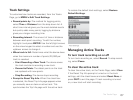
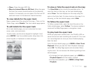
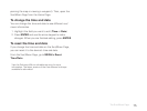
To view pro le statistics
To view statistical information about the pro le, from the
Pro le Page, go to MENU > View Pro le Statistics.
Use the right and left buttons on the arrow keypad to
scroll through the statistics pages.
Start to Finish–View speed, elevation, and trip
statistics for the entire track.
Start to Cursor–When you have panned along the
track, view speed, elevation, and trip statistics from
the track start to the track point at the cursor location.
Cursor to Finish–When you have panned along the
track, view speed, elevation, and trip statistics from
the track point at the cursor location to the track nish.
Cursor Point Info–When you have panned along the
track, view coordinates, time/date, elevation, grade,
speed, and GPS status for that speci c point
on the track.