


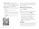
26
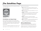
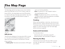
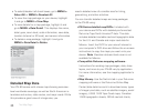
The Map Page
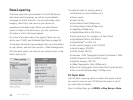
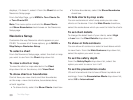
To select/deselect all check boxes, go to MENU >
Select All or MENU > Deselect All.
To view the map package on your device, highlight
it and go to MENU > View Map.
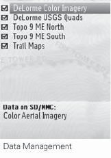
To view details for a map package, highlight it and
go to MENU > Data Detail. This displays the name,
data types, zoom level, scale information, save date,
location (internal or SD card), and version information.
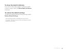
To delete a map package, highlight it and go to
MENU > Data Detail > Delete.
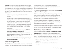
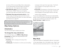
Detailed Map Data
Your PN-60 comes with a base map showing overview-
level worldwide coverage, as well as North American in-
terstates and routes, state routes, and major roads. While
this provides a great view of a large area, you
need a detailed view of a smaller area for hiking,
geocaching, and other activities.
You can transfer detailed maps and map packages
to the PN-60 using:
PN-Series detailed map DVDs–Included with
your device are DVDs with detailed pre-formatted
DeLorme Topo North America™ data. This data
includes detailed routable road and topographic data
for the U.S. and Canada and major road data for
Mexico. Insert the DVD for your area of interest in
your computer's DVD drive and follow the on-screen
instructions to copy the maps you want onto your
device. Note Elevation data and land cover is not
available for Mexico.
Compatible DeLorme mapping software–
Instructions for sending map packages, data, draw
layers, and more to your PN-60 vary by application.
For more information, see the mapping application’s
Help.
Map Library–Use the NetLink tab in your DeLorme
mapping software or the DeLorme Online Map
Center (data.delorme.com) to download many types
of imagery and data, such as satellite imagery, aerial
imagery, USGS 1:24K Topo Quad maps, Canadian
1:50K topographic sheets, NOAA nautical charts,