


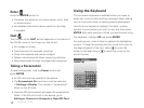
18
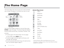
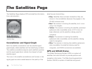
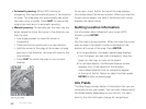
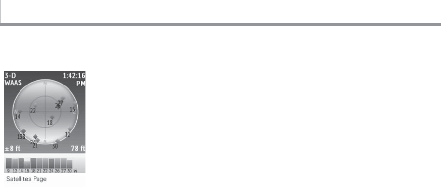
The Satellites Page displays GPS and satellite information,
time, and elevation.
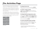
Constellation and Signal Graph
Both the satellite constellation and the satellite signal
graph display visible satellites and their identifying numbers.
The satellite constellation depicts each satellite’s position
and the signal graph bars indicate the strength of each
satellite signal.
The icons in the satellite constellation and the bars in the
signal graph are color-coded based on the quality of the
data they are transmitting:
Gray–Satellites have not been located but they are
shown in the constellation because they appear in the
PN-60’s almanac data.
Red–The receiver is tracking the satellite, but it is not
using it to navigate.
Yellow–The receiver is tracking the satellite, predicted
ephemeris data is available when a 3-D x has not
been obtained, and the satellite is being used for
navigation.
Green–The receiver is tracking the satellite,
ephemeris data is available, and the satellite is being
used for navigation.
Blue–The receiver is tracking the satellite, ephemeris
data is available, the satellite is being used for
navigation, and WAAS corrections are available.
GPS and WAAS Status
The Global Positioning System (GPS) is a system of
satellites that orbit the earth to provide position and
navigation information. The Wide Area Augmentation
System (WAAS) is system of satellites and ground
The Satellites Page
The Satellites Page