


48
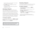
A waypoint is a location that you mark and store using the
PN-60. You can also transfer waypoint les to the PN-60.
Waypoints are identi ed by coordinates, and you can
assign a symbol, name, and other information to them.
The Waypoints Page lets you view a list of the active
waypoints on your PN-60. Waypoints are active when you:
Open a waypoint le
Mark a new waypoint
XMap users See the supplemental online help on the
DeLorme Wiki (pn60.wiki.delorme.com/xmap) for information
about using XMap with the Waypoints Page.
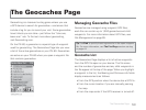
For information about geocache waypoints, see
The Geocaches Page section starting on page 53.
Managing Waypoint Files
Waypoints are managed using GPX les; each le can
contain up to 1,500 waypoints. For more information
about GPX les, see File Management starting on page 85.
Tip Use Find to quickly locate a waypoint in the open waypoint
le. For more information, see The Find Page section starting
on page 44.
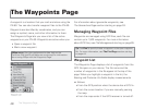
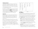
Waypoint List
The Waypoints Page displays a list of waypoints from the
GPX le open on your device. The le name and the
number of waypoints in the le appear at the top of the
page. When you highlight a waypoint in the list, the
Bearing and Distance info elds display measurements
as follows:
From the GPS position when the device has a GPS x.
From the cursor location if you are manually panning
the map.
From the map center if the GPS receiver is turned off.
The Waypoints Page
The Waypoints Page