


- 94 -
you deviate from it. When you miss a turn or avoid a roadblock, Venturer GPS
Navigation waits for a few seconds to be sure you do not follow the route any
more (you can ne-tune it in Advanced settings), then recalculates the route
based upon your new position and direction.
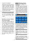
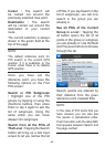
Automatic Day / Night Colors:
Based on the time and position given by the GPS device, Venturer GPS
Navigation is able to calculate when the sun rises and sets at your current
location on this particular day. Using that information Venturer GPS Navigation
can change between the day and the night color schemes a few minutes before
sunrise and a few minutes after sunset. As additional information to help your
orientation, the sun is shown in the sky when you display the map in 3D mode
with a low viewing angle, and the sun is near the horizon.
Elevation:
When the GPS receiver can see at least four GPS satellites, it can determine
its current position in three dimensions. In this case the elevation is calculated
together with the latitude/longitude position. Note that some older GPS
Navigators may provide incorrect elevation data because they use a simple
ellipsoidal earth model rather than a database that contains local sea levels.
You should also be aware that the elevation value is generally less accurate
(by at least a factor of 2) than the horizontal position. See also 2D/3D GPS
Reception.
ETA (Estimated Time of Arrival):
A frequently used expression in navigation. It represents the time when you will
reach your destination based upon calculations using the remaining part of the
route and available information of the roads used. This estimation can only be
used as a general reference. It will not be able to take into account your future
speed or the trafc delays. In Venturer GPS Navigation this value is shown as
‘Estimated Arrival’ on the Route Information screen.
ETE (Estimated Time Enroute):
Another frequently used expression in navigation. It represents the time needed
to reach your destination based upon calculations using the remaining part of
the route and available information of the roads used. This estimation can be
used only as a general reference. It will not be able to take into account your
future speed or the trafc delays. In Venturer GPS Navigation this value is
shown as ‘Time left’ on the Route Information screen.
GPS:
Abbreviation for Global Positioning System. This system is operated by the
DoD (the Department of Defense of the Navigatores States Government). It
consists of 24 satellites orbiting Earth, and several ground stations to keep the
satellites in sync. To calculate your position, your GPS device uses the signals