26
Chapter 1
Basic Operation
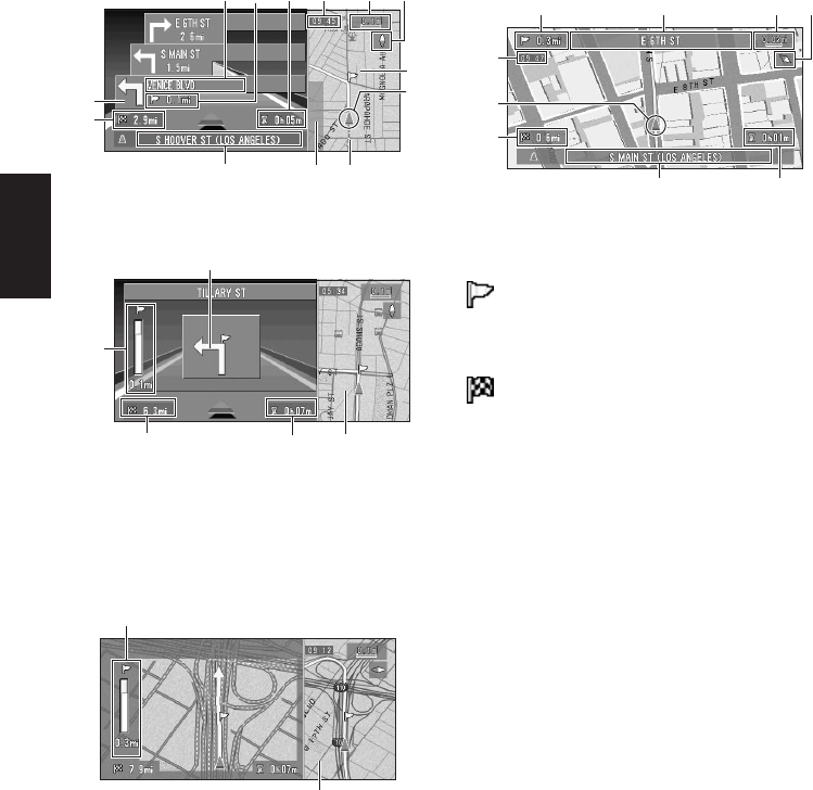
Route View
Displays the name of the street you will next
travel along and an arrow indicating the direction
of travel.
Enlarged map of the intersection
When “Close-up of Junction” in the Settings
menu is “On”, an enlarged map of the junction
appears. If driving on freeway, the special guide
illustration is displayed.
➲ Changing the close-up of junction setting ➞
Page 51
❒ When set to Driver’s View, the system can-
not be changed to an enlarged intersection
map.
City Map
In certain metropolitan city areas, a more
detailed “City Map” is available at the 0.05 mi
(50m) map scale or lower (only those cities
whose detailed city maps are registered in the
map disc).
Display items
Guidance point*
The next guidance point (next turning point, etc.)
is shown by a yellow flag.
Destination*
The checker-flag indicates your destination.
(1) Name of the next street to be used*
(2) Distance to the guidance point*
(3) Current location
The current location of your vehicle. The tip of the
triangular mark indicates your heading and the
display moves automatically as you drive.
(4) Distance to the destination*
(5) Name of the street your vehicle is
traveling along (or City Name, etc.)
(6) Compass
The red arrow shows North.
➲ Changing map direction ➞ Page 51
(7) Map scale
The scale of the map is indicated as a distance.
➲ Changing the map’s scale ➞ Page 27
(8) Current time
(9) Estimated time of arrival (or travel time to
your destination)*
➲ Displaying estimated time of arrival ➞
Page 50
Normal condition
When approaching an intersection
(When “Close-up of Junction” is off)
(1) (7)
(5)
(3)
(11)
(4)
(6)(8)
(14)
(10)
(13)
(9)
(13)
(4)
(12)
(11)(9)
(2)
(12)
(11)
(2) (1) (7)
(5) (9)
(3)
(4)
(8)
(6)


