


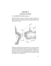
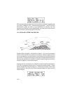
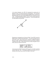
In the above illustration, the GPS 100 calculated the closest point of
approach as 025°, 5.9 nautical miles from the lighthouse. This is the point
along your route at which you will pass abeam the lighthouse. If you want this
point to be a part of your route, simply press the ENT key with the cursor over
“OK?”. This places a waypoint named “LTHS0” into your route giving you the
ability to navigate to the closest point of approach — and know exactly when
you pass abeam the lighthouse!
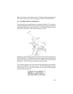
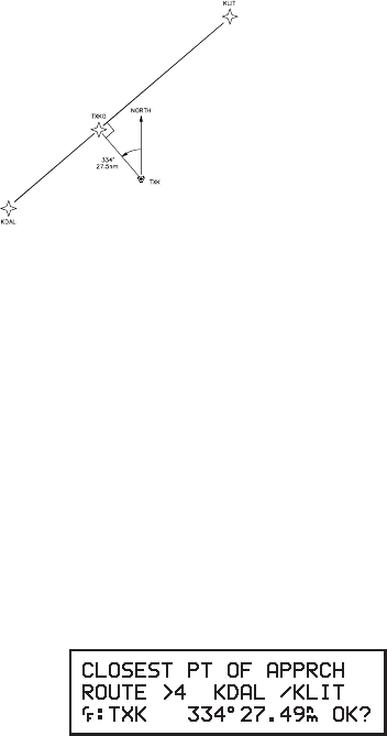
Suppose your are departing Love Airport in Dallas, Texas (KDAL) bound for
Adams Field in Little Rock, Arkansas (KLIT). You wish to proceed direct to
Little Rock, but Air Traffic Control (ATC) requires an additional waypoint
along your route. You determine that your direct route will take you past the
Texarkana VOR (TXK). Use the CPA function to create a waypoint on your
direct route from Dallas to Little Rock.
In this example, the GPS 100 created a CPA waypoint on the 334° radial 27.5
nautical miles from TXK. This waypoint allows you to comply with ATC
requests while flying a direct route from Dallas to Little Rock.
12-6