


· Multi-purpose Alarms: Dual alarm clocks and timers allow the GPS
100 to watch the clock for you. Arrival, anchor drag, CDI, and hazard
alerts help you safely navigate your craft.
· Offset navigation: The offset navigation feature allows you to
traverse your route a fixed distance left or right from a defined course.
· Interfaces: Interface with marine or aviation autopilots and graphical
plotters. Down load waypoints and routes to your PC for permanent
record.
We encourage you to read this manual and experiment using the built-in
simulator. This will help you quickly master the features of the GPS 100.
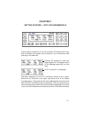
1.2 AVIATION DATABASE
The GPS 100 AVD features a built-in Jeppesen NavData
®
database providing
direct access to either North America, International or Worldwide navigational
information. When the GPS 100 AVD is turned on, the display will show
which database the unit contains. Information contained in the databases is
as follows:
· Airports: Identifier, latitude, longitude, elevation, and nearest VOR.
· VORs: Identifier, latitude, longitude, frequency, and co-located DME
(or TACAN) indication.
· NDBs: Identifier, latitude, longitude, and frequency.
· Intersections: Identifier, latitude, longitude, and nearest VOR.
The North American and International Databases contain this information for
all intersections, NDBs and VORs and most public use airports with runways
of 1,000 feet or greater. The North American Database covers Canada, the
continental United States, Alaska, Mexico, Central America, and the Bahamas.
The International Database covers the entire world except for the area
covered by the North American Database.
The Worldwide Database contains information for most public use airports
with runways of 1,000 feet or greater, all VORs, NDBs, named outer markers
and named final approach fixes for the entire world.
1-2