


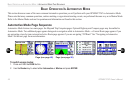
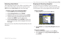
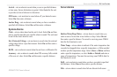

AUTOMOTIVE MODE PAGES AND FEATURES
This section discusses the major pages in Automotive Mode, such
as the Map page, as well as some additional features, such as Routes
and Points. For information about pages and features not discussed
here, refer to the “Marine Mode Pages and Features” section.
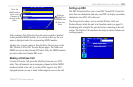
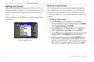
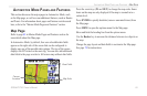
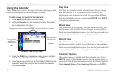
Map Page
Refer to page 43 in Marine Mode Pages and Features section for
more details about the Map page.
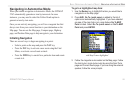
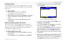
In Automotive Mode, by default, four user-selectable data fields
appear on the right side of the screen that can be configured to
display any one of the possible data options. The top of the screen
displays the GPS status or the route leg. You can also add additional
data fields to the page or select a full screen map without data fields.
Map Page
Data Fields
Map Scale
Current
Location
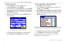
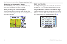
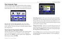
Press the zoom keys (IN and OUT) to change the map scale. Some
items on the map are only displayed if the map is zoomed in to a
certain level.
Press ENTER to quickly declutter (remove unwanted items) from
the Map page.
Press MENU to open the options menu for the Map page.
Show and hide the heading line from the options menu.
Use the Rocker key to measure the distance between two objects on
the map.
Change the page layout and data fields to customize the Map page.
See page 78 for instructions.
GPSMAP 276C Owner’s Manual 65
AUTOMOTIVE MODE PAGES AND FEATURES > MAP PAGE