


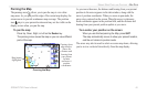
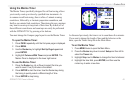
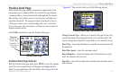
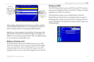
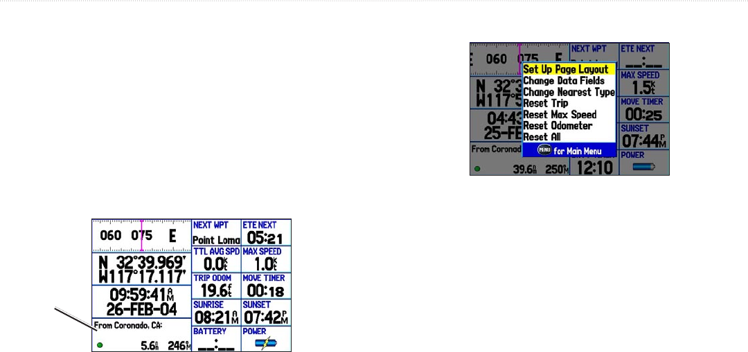
Position Data Page
The Position Data page displays important navigation data while
navigating a route in Marine Mode. By default, the page displays
a compass ribbon, your current latitude and longitude, the current
date and time, the location you are traveling from, and eight user-
selectable data fields. The compass ribbon is displayed at the top
of the page to show your current heading with a red, vertical bar.
To stay on course, steer towards the violet bar (or arrows) until it is
aligned with the red bar.
Press PAGE repeatedly to open the Position Data page.
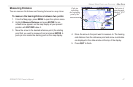
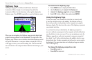
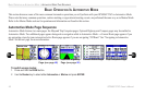
Position Data Page
Waypoint is
selected as the
Nearest Type.
Coronado, CA
is the nearest
waypoint.
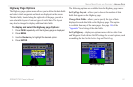
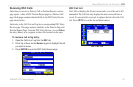
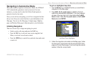
Position Data Page Options
With the Position Data page open, press MENU to open the options
menu. You can set up the layout of the page and change the data
fields. For an explanation of the data fields, refer to page 116 in the
“Appendix.” You can also select one of the following options:
Position Data Page Options Menu
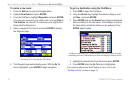
Change Nearest Type—allows you to specify the type of item to be
used as the nearest item (displayed in the lower-left data field). The
choices change based upon the Usage Mode you are currently using.
Reset Trip
—clears trip information, except the maximum speed and
the odometer.
Reset Max Speed—clears the maximum speed.
Reset Odometer—clears the running total of the distance traveled
since the odometer was last reset.
Reset All
—clears all trip information including the maximum speed
and odometer.
GPSMAP 276C Owner’s Manual 53
MARINE MODE PAGES AND FEATURES > POSITION DATA PAGE