


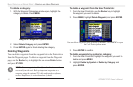
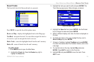
Following a Marine Route
After you activate a route, the GPSMAP 276C automatically starts
guiding you to the destination using a variety of tools and pages.
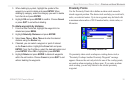
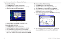
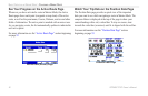
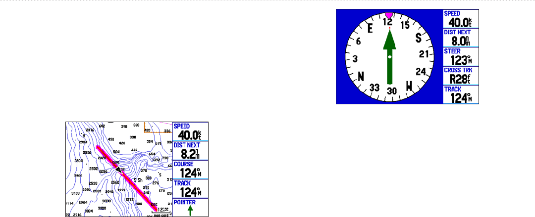
See Your Route on the Map Page
You can track the progress of your route on the Map page. Your
route is shown with a magenta line. For more information see the
“Map Page” section beginning on page 43.
Map Page
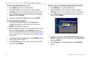
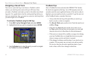
View Your Heading with the Compass Page
During active navigation, the Compass page guides you to your
destination with digital data fields and a graphic compass display
with a bearing pointer. When the pointer is pointing straight up, you
are heading directly to your destination. For more information see
“Compass Page” beginning on page 48.
Compass Page
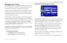
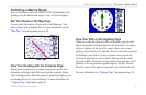
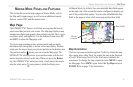
View Your Path on the Highway Page
Whenever a route has been activated, the Highway page provides
digital and graphic steering guidance to the destination. A compass
ribbon is displayed at the top of the page to show your current
heading, represented by the violet bar. The red vertical bar represents
the bearing to your course. To stay on course, steer towards the
red vertical indicator (or arrows) until it lines up with the violet
bar in the middle. The bottom section of the screen provides visual
guidance to the waypoint on a graphic highway display. The line
down the center of the highway represents your desired track line.
For more information see “Highway Page” beginning on page 50.
GPSMAP 276C Owner’s Manual 41
BASIC OPERATION IN MARINE MODE > FOLLOWING A MARINE ROUTE