


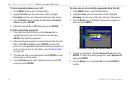
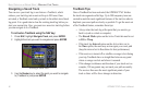
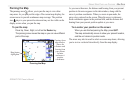
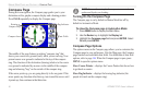

Zooming In and Out of the Map
The map display has 28 available zoom scales ranging from 20 ft
to 800 nm (20 ft to 800 mi or 5 m to 1200 km). The map scale is
controlled by the IN and OUT keys, with the current scale displayed
at the bottom right of the data window.
NOTE: The scale value represents the distance from one end of
the scale bar ( ) to the other.
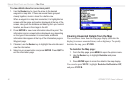
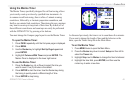
To select a map scale (zoom in and out):
• Press the OUT key to zoom out.
• Press the IN key to zoom in.
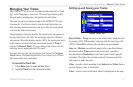
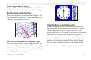
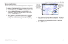
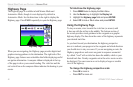
The system has a built-in worldwide database, with more detailed
coverage available through the use of the BlueChart or MapSource
data. The GPSMAP 276C displays cartography as long as there is
chart information available for the zoom scale you have selected.
Map coverage conforms to the following conditions:
• Cartography is displayed when the selected zoom scale is
covered by either the internal basemap or other MapSource
data loaded onto a data card.
• When the selected zoom scale is covered by both the internal
database and data card map information, the cartography with
the best resolution is displayed.
• When the selected zoom scale exceeds the resolution of the
data in use, “overzoom” appears below the map scale.
No additional data is available
• When external data (such as MapSource data) is used, “map
card” appears below the map scale.
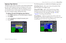
Using detailed maps loaded on the data card
44 GPSMAP 276C Owner’s Manual
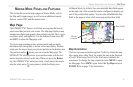
MARINE MODE PAGES AND FEATURES > MAP PAGE