


8
Getting Started
Main Pages/
Map Page
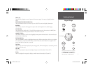
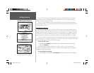
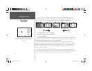
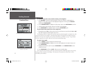
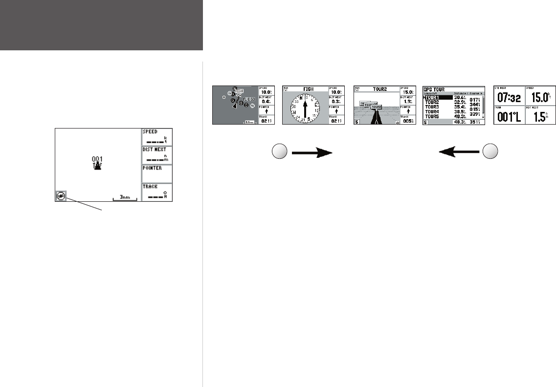
The GPS 152’s system displays fi ve main pages: the Map Page, Compass Page, Highway Page,
Active Route Page and Numbers Page. All fi ve pages are linked together in a simple chain, which
allows you to scroll through the pages in either direction using the PAGE and QUIT keys.
To continue the tour, move to the Map Page.
To scroll to the next page in sequence:
1. Press the PAGE key.
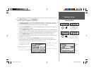
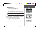
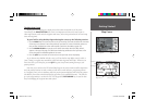
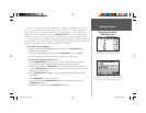
The GPS 152’s Map Page combines trackplotting with a user-selectable display of navigation data.
It will also be the page you use most to create and edit waypoints and routes. Before you take off on a
practice route, take a brief look at its various features and displays.
The map display shows your “boat” as a triangle marker. City names (Larger than 200,000
population), marine markers and buoys (for the Americas only, preloaded from the factory) are also
shown. Additionally, it displays your track, routes and nearby waypoints. An on-screen cursor lets
you pan to other map areas, determine the range and bearing to a position, and perform various
waypoint and route functions.
The data window, located on the right side of the page, provides a user-selectable display of
various navigation data, including course, speed over ground, and bearing and distance to a particular
waypoint. The current map scale setting is located at the bottom right of the map window.
Map Page Active Route PageHighway Page
Compass Page
Numbers Page
PAG E
QUIT
Before satellite acquisition, or if satellite reception is lost,
this icon in the lower left corner indicates that there is
no GPS fi x.
152 Manual Part 1.indd 8 11/27/2002, 2:55:48 PM