


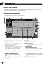
This key will be displayed while you activate
the dummy run (“Fly over” or “Demo
Mode”). Touch the key to cancel the dummy
run.
= For details, refer to Demo Mode on
page 150.
= For details, refer to Playing simulated tra-
vel at high speed on page 60.
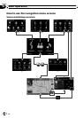
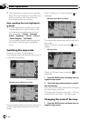
9 Album artwork on iPod
If you connect your iPod to this navigation sys-
tem, the artwork for the album that is playing
appears.
a Shortcut to the AVoperation screen
The AV Source currently selected is shown.
Touchingthe indicator displays the AVopera-
tion screen of the current source directly.
b Extension tab for the AV information bar
Touchingthis tab opens the AV information
bar and enables you to briefly view the current
status on the AV source. Touching it again re-
tracts the bar.
c Current route*
The route currently set is highlighted in bright
color on the map. If a waypoint is set on the
route, the route after the next waypoint is
highlighted in another color.
d Current position
Indicates the current location of your vehicle.
The apex of the triangular mark indicates your
orientation and the display moves automati-
cally as you drive.
p The apex of the triangular mark is the
proper current position.
e Street name (or city name) that your vehi-
cle is traveling along
f Multi-Info window
Shows the value on the items selected on
“Displayed Info”. Touching this area allows
you to display the “Route Information”
screen.
= For details, refer to Displayed Info on
page 147.
= For details, refer to Checking the current
route conditions on page 59.
p This item is not shown when “Full
Screen Map” is set to “On”.
= For details, refer to Map Settings on
page 146.
p The estimated time of arrival is an ideal
value that the navigation system com-
putes internally as the route is calcu-
lated. The estimated time of arrival
should be read just as a reference value,
and does not guarantee arrival at the
time indicated.
g Map scale
The scale of the map is indicated by distance.
h Second Maneuver Arrow*
Shows the turning direction after next and the
distance to there.
p This item is not shown when “Full
Screen Map” is set to “On”.
= For details, refer to Map Settings on
page 146.
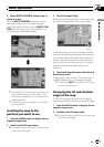
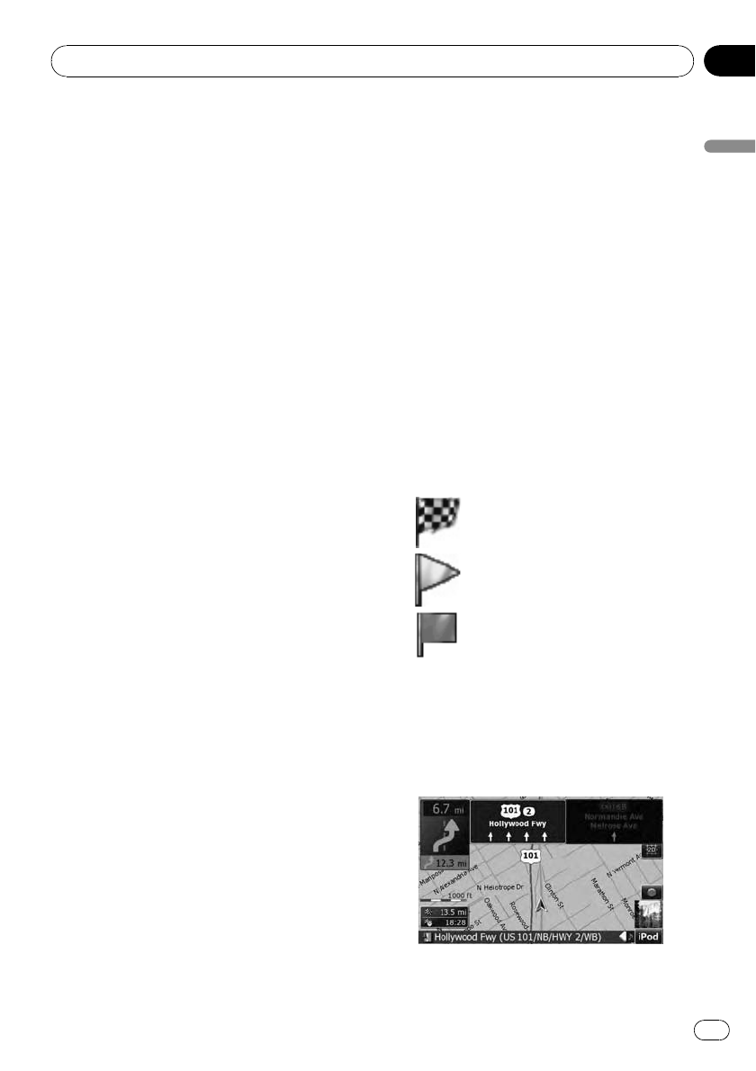
Meaning of guidance flags
: Destination
The checkered flagindicates your
destination.
: Waypoint
The yellowflags indicate your way-
points.
: Startpoint
The bright greenflag indicates
your start point.
Signpost and recommended lane
Signposts will appear together with the recom-
mended lane where multi-lane roads exist
when you are driving on your route. The high-
lighted lane indicates the recommended lane.
Basic operation
En
37
Chapter
02
Basic operation