


45
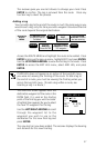
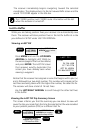
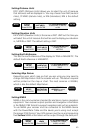
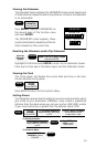
Setting Distance Units
DIST. UNITS (Distance Units) allows you to select the unit of measure
that distances will be displayed in. You may choose from NM (nautical
miles), ST.MILES (statute miles), or KM (kilometers). NM is the default
setting.
MENU
Highlight
SETUP
Press ENTER
Highlight
DIST UNITS
Press ENTER
Use UP/DOWN ARROWS
to select NM, ST MILES,
or KM
ENTER
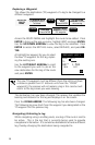
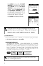
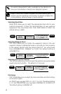
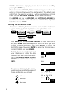
Setting Elevation Units
ELEV. UNITS (Elevation Units) is the same as DIST. UNIT but this time you
will select the unit of measure that will be used to display your elevation
in, METERS or FEET. The default setting is FEET.
MENU
Highlight
SETUP
Press ENTER
Highlight
ELEV UNITS
Press ENTER
Use UP/DOWN ARROWS
to select FEET or
METERS
ENTER
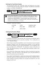
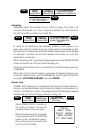
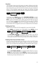
Setting North Reference.
This sets the north reference of the displays to TRUE or MAGNETIC. The
default North reference is MAGNETIC.
MENU
Highlight
SETUP
Press ENTER
Highlight
NORTH REF
Press ENTER
Use UP/DOWN ARROWS
to select MAGNETIC or
TRUE
ENTER
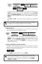
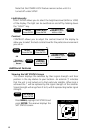
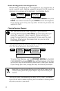
Selecting Map Datum
Depending upon which map or chart you are using you may need to
change the Map Datum that the receiver will use. The datum required
will be printed on the map or chart. The most common is WGS84,
which is also the default Map Datum.
MENU
Highlight
SETUP
Press ENTER
Highlight
MAP DATUM
Press ENTER
Use UP/DOWN
ARROWS to select
Map Datum
ENTER
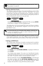
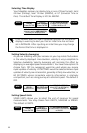
Setting NMEA
NMEA is the communication standard for electronic marine navigation
equipment. Your receiver outputs position and navigation information
in the NMEA 0183 format to support navigation aids such as autopilots.
To use NMEA your receiver must be connected to the NMEA device
with the Power/Data Cable and the device you’re using must accept
the proper 0183 format. Your GPS receiver must be on and computing
fixes before NMEA information will be output through the data port.
MENU
Highlight
SETUP
Press ENTER
Highlight
NMEA
Press ENTER
Use UP/DOWN ARROWS
to select OFF, 0183A,
0183B, or 0183C
ENTER