


70
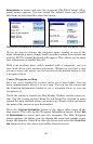
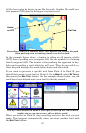
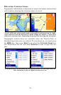
3. Point 1 is now half-way down the list. It should be at the bottom, just
above the text "(Add to list)". 4. Use the UP and DOWN buttons to move
the points until they are all in reverse order, with the original end
point at the top of the list. With the end point selected, press the DIRECT
TO button and navigation begins.
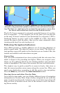
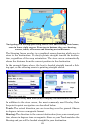
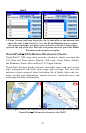
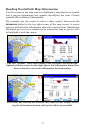
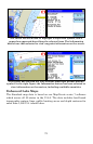
NauticPath™ USA Marine Electronic Charts
NauticPath™ USA map data provides electronic charts covering the
U.S. East and West coasts, Hawaii, Gulf coast, Great Lakes, Alaska,
the Bahamas, Puerto Rico and the U.S. Virgin Islands.
NauticPath features depth contours, intertidal zones and spot sound-
ings, navigational aids with view range and coverage. You can view
extensive object-oriented detail including list of lights, tides and cur-
rents, wrecks and obstructions, marine services, restricted areas and
anchorage database information.
These figures show the offshore/coastal detail you will get when using
NauticPath™ USA marine charts in the iWAY.
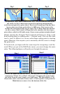
Step 3
Step 4