


59
Section 6:
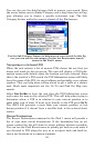
Point-to-Point Navigation
The iWAY 600C's primary job is providing turn-by-turn road naviga-
tion, but it can also display plot trails and perform traditional straight-
line or point-to-point navigation in off road situations.
This section will explain how to operate the unit in point-to-point navi-
gation mode and how to use the two additional map sets described be-
low. In this section, we assume you already have a basic understanding
of the buttons, menus and turn-by-turn functions.
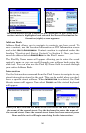
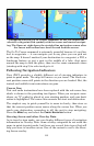
In addition to the turn-by-turn NAVTEQ™ road maps, the hard drive
also contains NauticPath™ USA marine coastal charts and MapCre-
ate™ topographical maps for North America. The MapCreate series 7
data contains thousands of inland lakes with bottom contours and
other underwater details.
Turn-by-turn navigation does not work with any of these optional
point-to-point map sets.
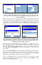
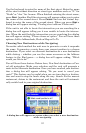
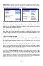
NOTE:
When using Standard (MapCreate) or NauticPath map data, you
must search for POIs with the
SEARCH ALL POIS BY NAME button. The
other search categories do not work with these point-to-point maps.
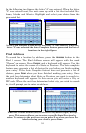
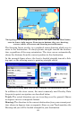
On the map, if a symbol for a POI or other item is selected with the
cursor, pressing the Location Information button displays a POI in-
formation screen for that item.
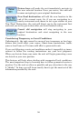
Caution:
The iWAY 600
C is designed for primary use inside automobiles,
but the waterproof case and point-to-point navigation make it
suitable for the outdoors. However, the automotive mounting
bracket is not designed for boats, motorcycles or off-road vehi-
cles. These installation types require an optional bracket and
cradle designed for rugged outdoor use.
If you are interested in outdoor mounts, see the accessory ordering in-
formation inside this manual's back cover.
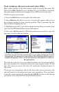
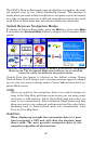
About Straight-line Navigation Mode (Point-to-Point)
You have probably heard the old adage, "The shortest distance between
two points is a straight line." Well, that's exactly what straight-line
navigation is. It allows you to create a straight-line navigation course
between yourself and another point on the map screen.